|
search place name
|
||
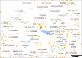
Oesanbuk (P'yŏngan, Korea, North)Oesanbuk is a town in the P'yŏngan region of Korea, North. An overview map of the region around Oesanbuk is displayed below.
regional and 3d topo map of Oesanbuk, Korea, North ::
Oesanbuk airports ::
The nearest airport is FNJ - Pyongyang Intl, located 76.7 km south east of Oesanbuk.
Nearby towns ::
Wŏnjil-li (1.0km north west) //
Kirha-dong (1.1km north) //
Yangji (1.8km north east) //
Simch'ŏndong-Kan-ni (2.0km east) //
Panggogae (2.9km north east) //
Simch'ŏn-dong (2.8km north east) //
Saja-dong (3.6km south) //
Oryong (3.8km north) //
Oryong-dong (4.3km north) //
Yonggok (3.5km east) //
Kilsang-dong (3.7km west) //
Naesan-ni (3.9km south east) //
Pongmyŏngdong-Simwŏn (3.9km south east) //
Haengdam-ni (4.4km south east) //
Changgyŏng-dong (4.1km south west) //
Puk-tong (4.1km north west) //
Karhyŏn-dong (4.8km south west) //
Palsal-li (5.2km north) //
Taeal-li (5.7km north) //
Amdu-ri (5.0km south east) //
Ch'ungdal (4.7km east) //
Tangsang-ni (5.9km south) //
Chussi-dong (6.1km south west) //
Pongmyŏng-ni (5.2km east) //
Saek-kol (5.7km south east) //
Ibam (5.3km east) //
Tŏk-tong (7.1km south) //
Kaewŏn-dong (6.4km south west) //
Soamdongsinwŏn (7.0km south east) //
[all distances 'as the bird flies' and approximate]  Places with similar names to Oesanbuk, Korea, North ::
Disclaimer :: Information on this page comes without warranty of any kind |
||
|
Where is Oesanbuk? Elevation and coordinates ::
Latitude (lat): 39°47'57"N Longitude (lon): 125°10'34"E
Elevation (approx.): 75m (map arrows pan, magnifying glasses zoom) |
||
|
Visiting Oesanbuk? Hotel/Accommodation ::
Book a hotel in Oesanbuk Travel Guide ::
rental cars ::
car rental offers GPS waypoint ::
download a GPX waypoint (PoI) of Oesanbuk for your GPS receiver
|
||