|
search place name
|
||
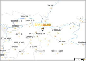
Onsŏng-ŭp (Hamgyŏng, Korea, North)Onsŏng-ŭp is a town in the Hamgyŏng region of Korea, North. An overview map of the region around Onsŏng-ŭp is displayed below.
regional and 3d topo map of Onsŏng-ŭp, Korea, North ::
Nearby towns ::
Simch'ŏng-ni (2.1km south east) //
Hyangdang-ni (2.3km west) //
Ont'al-lodongjagu (3.2km south west) //
Chuwŏl-lodongjagu (3.7km south) //
Liangshui (4.3km north) //
Sanghwa-rodongjagu (4.6km south) //
P'unggyo-dong (4.9km south east) //
P'ungil-lodongjagu (4.6km south east) //
Sesŏl-li (4.6km west) //
Chaein-ch'on (4.7km east) //
Kuŏk-tong (5.1km north west) //
Chebong-ch'on (6.3km south) //
Yongnam-ni (5.5km south west) //
Wangjaesal-li (5.1km east) //
Humyoch'on (6.7km south west) //
Changsadŭk (6.6km south east) //
Taejang-dong (8.5km south) //
P'ungsŏ-ri (7.6km north west) //
Wŏlp'a-ri (8.7km south east) //
[all distances 'as the bird flies' and approximate] 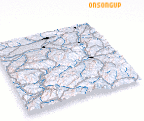 Places with similar names to Onsŏng-ŭp, Korea, North :: Disclaimer :: Information on this page comes without warranty of any kind |
||
|
Where is Onsŏng-ŭp? Elevation and coordinates ::
Latitude (lat): 42°57'26"N Longitude (lon): 129°59'36"E
Elevation (approx.): 84m (map arrows pan, magnifying glasses zoom) |
||
|
Visiting Onsŏng-ŭp? Hotel/Accommodation ::
Book a hotel in Onsŏng-ŭp Travel Guide ::
rental cars ::
car rental offers GPS waypoint ::
download a GPX waypoint (PoI) of Onsŏng-ŭp for your GPS receiver
|
||