|
search place name
|
||
Ŏyu-ri (Hamgyŏng, Korea, North)Ŏyu-ri is a town in the Hamgyŏng region of Korea, North. An overview map of the region around Ŏyu-ri is displayed below.
regional and 3d topo map of Ŏyu-ri, Korea, North ::

Nearby towns ::
Kwihyang-dong (0.8km east) //
Musudŏgi (0.9km west) //
Ayang-dong (1.3km south west) //
Sup'ul-gol (2.0km north west) //
Ch'ajang-dong (1.8km east) //
Samdang (2.2km south east) //
Sŏngjo-dong (3.1km north west) //
Puam-dong (5.0km south) //
Ilgŏn-dong (5.3km south) //
Chagŭn-gol (4.9km north east) //
Chajŏng-dong (5.8km south) //
Tŏktal-gol (6.0km north) //
Simch'ŏn-gol (5.7km south east) //
Hwalbat-kol (4.7km east) //
Kogaemit (5.2km south east) //
Pop'yŏngbu (7.4km south) //
Taedal-gol (7.7km north) //
Osang-ni (7.8km south) //
Ch'uga-gol (6.1km east) //
Pogolbu (7.6km south) //
Sangp'yŏng (7.3km south east) //
Kangbyŏnmaŭl (7.5km south east) //
Sangdangbu (8.3km south) //
Ch'ajang-dong (6.4km east) //
Chungp'yŏng (7.6km south east) //
Noyabu (8.7km south) //
Mindunbu (7.8km south west) //
Yongambu (8.9km south) //
Hoehyang-ni (7.4km south east) //
[all distances 'as the bird flies' and approximate] 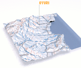 Places with similar names to Ŏyu-ri, Korea, North ::
Disclaimer :: Information on this page comes without warranty of any kind |
||
|
Where is Ŏyu-ri? Elevation and coordinates ::
Latitude (lat): 41°46'52"N Longitude (lon): 129°33'56"E
Elevation (approx.): 151m (map arrows pan, magnifying glasses zoom) |
||
|
Visiting Ŏyu-ri? Hotel/Accommodation ::
Book a hotel in Ŏyu-ri Travel Guide ::
rental cars ::
car rental offers GPS waypoint ::
download a GPX waypoint (PoI) of Ŏyu-ri for your GPS receiver
|
||