|
search place name
|
||
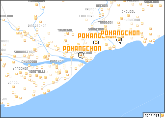
P'ohang-ch'on (Hamgyŏng, Korea, North)P'ohang-ch'on is a town in the Hamgyŏng region of Korea, North. An overview map of the region around P'ohang-ch'on is displayed below.
regional and 3d topo map of P'ohang-ch'on, Korea, North ::
Nearby towns ::
Chung-ch'on (0.5km north) //
Sinho-ri (0.6km east) //
Kojang-ni (0.8km south east) //
Hanggu 1-tong (1.2km south) //
Songp'yŏng-ni (1.5km south) //
Kanjin (1.2km east) //
Ch'angjin (1.5km east) //
Tongho-ri (2.1km north) //
Yongsŏng-ni (1.8km north west) //
Kip'yŏng-ni (2.0km west) //
Naemul-li (2.4km north west) //
Haean 1-tong (2.4km south west) //
Pau-ch'on (2.4km north east) //
Songguman (2.9km north) //
Noha-ch'on (2.6km south west) //
Kirin-ch'on (2.7km north east) //
Tot'o-gol (3.2km north west) //
Oemul-li (3.4km north) //
Yongsal-li (3.1km north east) //
Munho-ri (3.7km north) //
Tanch'ŏn (3.2km north west) //
Tŏkch'ŏl-li (3.1km west) //
Taehŭng-ni (3.3km west) //
Tuŏnt'ae-ri (3.5km south west) //
Pohang-ch'on (3.9km north east) //
Yurimjang (4.0km north west) //
Pak-ch'on (3.6km south west) //
Wŏn-gol (4.5km north) //
Kok-ch'on (3.9km south west) //
[all distances 'as the bird flies' and approximate] 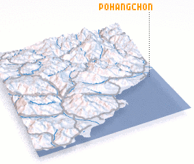 Places with similar names to P'ohang-ch'on, Korea, North ::
Disclaimer :: Information on this page comes without warranty of any kind |
||
|
Where is P'ohang-ch'on? Elevation and coordinates ::
Latitude (lat): 40°26'40"N Longitude (lon): 128°55'59"E
Elevation (approx.): 6m (map arrows pan, magnifying glasses zoom) |
||
|
Visiting P'ohang-ch'on? Hotel/Accommodation ::
Book a hotel in P'ohang-ch'on Travel Guide ::
rental cars ::
car rental offers GPS waypoint ::
download a GPX waypoint (PoI) of P'ohang-ch'on for your GPS receiver
|
||