|
search place name
|
||
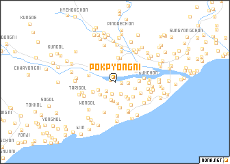
Pokp'yŏng-ni (Hamgyŏng, Korea, North)Pokp'yŏng-ni is a town in the Hamgyŏng region of Korea, North. An overview map of the region around Pokp'yŏng-ni is displayed below.
regional and 3d topo map of Pokp'yŏng-ni, Korea, North ::
Nearby towns ::
Chungsŏm (0.6km north west) //
Tolgogae-gol (0.8km east) //
Chossi-dong (2.0km south) //
Yussi-dong (1.8km south west) //
Min'ga-gol (1.7km east) //
Yongyŏl-li (2.1km south) //
Paeksal-li (2.3km north) //
Ha-ch'on (2.4km north) //
Chung-ch'on (2.7km north) //
U-ch'on (2.8km north) //
Suryŏn-dong (2.7km south west) //
Yonghŭng-ni (2.9km south) //
Yang-ch'on (2.4km south west) //
Chagol-ch'on (2.8km south east) //
Sinhŭng-ch'on (2.8km north west) //
Kan-gol (2.7km south west) //
Hŭngyong-ch'on (3.2km south) //
Nae-dong (2.7km south east) //
Yongho-ch'on (3.2km south east) //
Chaegung-gol (3.0km north east) //
Tŏk-ch'on (3.6km south) //
Koryŏngniha-ch'on (3.3km north east) //
Ojang-ch'on (3.3km south east) //
Yŏngsal-li (3.2km north east) //
Chŏktaedŏk (3.9km north) //
Nodong-ni (3.2km south west) //
Nŭp-kol (3.0km east) //
Yŏndaerian-gol (4.0km north) //
Yonggangnijung-ch'on (4.2km south) //
[all distances 'as the bird flies' and approximate]  Places with similar names to Pokp'yŏng-ni, Korea, North ::
// Pokp'yŏng-ni (KR)
// Pukp'yŏng-ni (KP)
Disclaimer :: Information on this page comes without warranty of any kind |
||
|
Where is Pokp'yŏng-ni? Elevation and coordinates ::
Latitude (lat): 40°25'42"N Longitude (lon): 128°49'50"E
Elevation (approx.): 16m (map arrows pan, magnifying glasses zoom) |
||
|
Visiting Pokp'yŏng-ni? Hotel/Accommodation ::
Book a hotel in Pokp'yŏng-ni Travel Guide ::
rental cars ::
car rental offers GPS waypoint ::
download a GPX waypoint (PoI) of Pokp'yŏng-ni for your GPS receiver
|
||