|
search place name
|
||
Pomak-tong (Hwanghae, Korea, North)Pomak-tong is a town in the Hwanghae region of Korea, North. An overview map of the region around Pomak-tong is displayed below.
regional and 3d topo map of Pomak-tong, Korea, North ::

Pomak-tong airports ::
The nearest airport is GMP - Seoul Gimpo, located 88.1 km south of Pomak-tong.
Other airports nearby include SSN - Seoul East Seoul Ab (108.1 km south east), FNJ - Pyongyang Intl (128.9 km north west), OSN - Osan Ab (143.2 km south), SHO - Sokch'o Sokcho (173.3 km east), Nearby towns ::
Wangp'o-dong (0.5km north east) //
Kach'ŏ-dong (1.1km south east) //
Songse-ri (1.3km south east) //
Kanŭn'gae (1.6km south) //
No-dong (1.6km north west) //
Pudae-dong (1.9km north) //
Siktang-dong (1.7km north east) //
Changdae-dong (1.9km south west) //
Songch'on (2.2km south) //
Ch'ogu-dong (2.1km south east) //
Wŏn'galgogae (2.5km north) //
Wŏn'ga-dong (2.5km north) //
Karhyŏn-dong (2.2km north east) //
Sinch'on (2.3km north west) //
Paengmok-tong (2.6km north west) //
Punt'o-dong (2.3km east) //
Omok-tong (2.9km south) //
Kwangsŏng-dong (3.0km south) //
Sinsŏng-ni (3.1km north) //
Hwagok-tong (2.9km south west) //
Tokchang-dong (2.9km north west) //
Paekhwa-ri (2.9km south west) //
Tongsan-dong (2.9km east) //
Kojanjŏm (3.0km east) //
Kojan-dong (3.1km south east) //
Sajŏn-dong (3.6km north west) //
Ch'imt'an-dong (3.6km north east) //
Chŏmch'on-dong (3.2km west) //
Manho-dong (4.0km south) //
[all distances 'as the bird flies' and approximate] 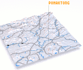 Places with similar names to Pomak-tong, Korea, North ::
// Pum-gahtawng (MM)
// Pumgahtawng (MM)
// Pumkahtawng (MM)
// P'imok-tong (KP)
// P'imok-tong (KP)
// P'imok-tong (KP)
// Pomak-tong (KP)
// Pomok-tong (KR)
// P'imok-tong (KP)
// P'imok-tong (KP)
Disclaimer :: Information on this page comes without warranty of any kind |
||
|
Where is Pomak-tong? Elevation and coordinates ::
Latitude (lat): 38°20'33"N Longitude (lon): 126°38'7"E
Elevation (approx.): 66m (map arrows pan, magnifying glasses zoom) |
||
|
Visiting Pomak-tong? Hotel/Accommodation ::
Book a hotel in Pomak-tong Travel Guide ::
rental cars ::
car rental offers GPS waypoint ::
download a GPX waypoint (PoI) of Pomak-tong for your GPS receiver
|
||