|
search place name
|
||
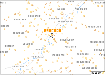
Psoch'am (P'yŏngan, Korea, North)Psoch'am is a town in the P'yŏngan region of Korea, North. An overview map of the region around Psoch'am is displayed below.
regional and 3d topo map of Psoch'am, Korea, North ::
Psoch'am airports ::
The nearest airport is FNJ - Pyongyang Intl, located 91.8 km south west of Psoch'am.
Nearby towns ::
Chungch'am (0.7km south east) //
Yŏllyongch'am (0.8km north east) //
Yongyŏnch'am (1.1km north) //
Ŏguch'am (1.5km north) //
Haenggangch'am (1.3km north west) //
Hach'am (1.4km south east) //
Hwap'yŏngch'am (1.8km south west) //
Hwaguch'am (1.9km south east) //
Puksinhyŏl-li (2.0km north east) //
P'yobung-ni (2.3km south) //
Noha-dong (2.5km north) //
Noha-ri (2.1km north west) //
Kuryongch'am (2.4km north east) //
Sangnodongsangch'am (2.2km west) //
Karak-kol (2.8km south) //
Yŏunhach'am (3.1km north east) //
Kadŏkch'am (3.5km north) //
Yŏunjungch'am (3.0km north east) //
Nojungch'am (3.7km north) //
Wŏn-mal (3.6km south west) //
Tapchungch'am (3.3km north west) //
Tapsangch'am (3.6km north west) //
Chungch'am (3.3km west) //
Taphach'am (3.4km west) //
Nohyŏl-li (3.8km north east) //
Sangno-ri (3.7km west) //
Saet-kol (4.7km south west) //
Yangmul-gol (4.9km south) //
Yŏunsangch'am (3.9km east) //
[all distances 'as the bird flies' and approximate] 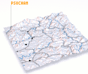 Places with similar names to Psoch'am, Korea, North ::
// Postioma (IT)
// Pozo Chambi (PY)
Disclaimer :: Information on this page comes without warranty of any kind |
||
|
Where is Psoch'am? Elevation and coordinates ::
Latitude (lat): 39°58'26"N Longitude (lon): 126°7'15"E
Elevation (approx.): 107m (map arrows pan, magnifying glasses zoom) |
||
|
Visiting Psoch'am? Hotel/Accommodation ::
Book a hotel in Psoch'am Travel Guide ::
rental cars ::
car rental offers GPS waypoint ::
download a GPX waypoint (PoI) of Psoch'am for your GPS receiver
|
||