|
search place name
|
||
Pukp'o-ri (Korea, North)Pukp'o-ri is a town in Korea, North. An overview map of the region around Pukp'o-ri is displayed below.
regional and 3d topo map of Pukp'o-ri, Korea, North ::

Pukp'o-ri airports ::
The nearest airport is FNJ - Pyongyang Intl, located 47.5 km south east of Pukp'o-ri.
Nearby towns ::
Chigyŏng-ni (0.0km north) //
Haksan-ni (0.6km north west) //
Unsong-ni (1.0km west) //
Kokha-ri (1.9km north) //
Unhak-tong (1.4km west) //
Hail-li (1.9km south) //
Ŭpch'on-ni (1.9km south) //
Kangsŏ-dong (1.4km west) //
Anyang-ni (2.3km north) //
Sŏgu-ri (2.3km north west) //
Unhaktong-Tongso-ri (2.3km south west) //
Tansan-ni (2.5km south east) //
Yongjin-dong (3.0km north west) //
Kalmagu (3.5km north) //
Sinjang-ni (3.4km north east) //
Kŭmgye-ri (4.0km north) //
Songdam-dong (4.0km north) //
Songji-ri (4.0km north) //
Sŏngsan-dong (4.0km north) //
Sinsŏl-li (3.4km south east) //
Hakhyŏn-ni (4.0km north) //
Naehŭng-ni (4.0km north) //
Unsan-dong (3.4km south west) //
Yŏngdun-ni (4.0km north) //
Sŏwŏn-ni (3.7km north east) //
Mangu-dong (3.8km south east) //
Sŏbaeng-ni (5.0km north) //
Kyunhŭng-ni (4.0km east) //
Kŭnjang-dong (4.7km north east) //
[all distances 'as the bird flies' and approximate] 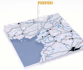 Places with similar names to Pukp'o-ri, Korea, North ::
// Pakupriai I (LT)
// Pakupriai II (LT)
// Paikpāra (BD)
// Paikpāra (BD)
// Paikpāra (BD)
// Paikpāra (BD)
// Pāikpāra (BD)
// Pāikpāra (BD)
// Pāikpāra (BD)
// Pāikpāra (BD)
Disclaimer :: Information on this page comes without warranty of any kind |
||
|
Where is Pukp'o-ri? Elevation and coordinates ::
Latitude (lat): 39°37'0"N Longitude (lon): 125°27'0"E
Elevation (approx.): 7m (map arrows pan, magnifying glasses zoom) |
||
|
Visiting Pukp'o-ri? Hotel/Accommodation ::
Book a hotel in Pukp'o-ri Travel Guide ::
rental cars ::
car rental offers GPS waypoint ::
download a GPX waypoint (PoI) of Pukp'o-ri for your GPS receiver
|
||