|
search place name
|
||
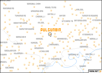
Pulgŭnbin (P'yŏngan, Korea, North)Pulgŭnbin is a town in the P'yŏngan region of Korea, North. An overview map of the region around Pulgŭnbin is displayed below.
regional and 3d topo map of Pulgŭnbin, Korea, North ::
Pulgŭnbin airports ::
The nearest airport is FNJ - Pyongyang Intl, located 89.3 km south west of Pulgŭnbin.
Nearby towns ::
P'ungdŏng-ni (1.0km east) //
Waksae-dong (1.3km east) //
P'unggong-ni (1.5km north east) //
Yangji-ch'on (2.1km north) //
Chŏl-gol (2.3km south) //
Nojang-dong (2.6km north) //
Sang-gol (2.4km west) //
Noeraek-kol (3.1km north east) //
Non-gol (3.0km south east) //
Sulgunŏmi (3.5km south) //
Changsu-dong (3.2km north west) //
Oksang-dong (3.4km north east) //
Chandibŏl (4.2km south) //
Mai-dong (4.3km north) //
Kan-gol (3.6km south west) //
Nae-gol (4.0km south west) //
Ŏrimak-kol (3.9km south east) //
Sanhaeng-gol (4.9km north) //
Kaehwa-ri (5.0km north) //
Kil-gol (4.8km north west) //
Ansang-ni (4.7km south west) //
Sindŏk-tong (4.6km west) //
Chaeyugae (6.0km south) //
Yongho-dong (6.0km north) //
Turyugae (4.8km east) //
Yŏnch'ang-gol (5.6km south east) //
Sumok-tong (5.7km north east) //
Samgŏ-ri (6.2km south east) //
Yŏngung-ni (6.2km south east) //
[all distances 'as the bird flies' and approximate] 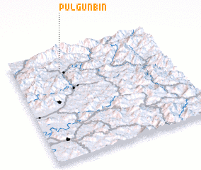 Places with similar names to Pulgŭnbin, Korea, North ::
// Plei Quanban (VN)
Disclaimer :: Information on this page comes without warranty of any kind |
||
|
Where is Pulgŭnbin? Elevation and coordinates ::
Latitude (lat): 39°51'4"N Longitude (lon): 126°19'12"E
Elevation (approx.): 319m (map arrows pan, magnifying glasses zoom) |
||
|
Visiting Pulgŭnbin? Hotel/Accommodation ::
Book a hotel in Pulgŭnbin Travel Guide ::
rental cars ::
car rental offers GPS waypoint ::
download a GPX waypoint (PoI) of Pulgŭnbin for your GPS receiver
|
||