|
search place name
|
||
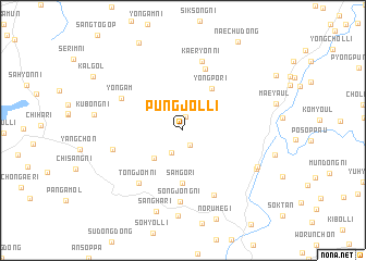
P'ungjŏl-li (Kangwŏn, Korea, North)P'ungjŏl-li is a town in the Kangwŏn region of Korea, North. An overview map of the region around P'ungjŏl-li is displayed below.
regional and 3d topo map of P'ungjŏl-li, Korea, North ::
P'ungjŏl-li airports ::
The nearest airport is GMP - Seoul Gimpo, located 117.8 km south of P'ungjŏl-li.
Other airports nearby include FNJ - Pyongyang Intl (119.9 km north west), SSN - Seoul East Seoul Ab (132.8 km south), SHO - Sokch'o Sokcho (164.5 km east), OSN - Osan Ab (170.7 km south), Nearby towns ::
Kaek-kol (1.4km north) //
Hwap'ung-ni (1.6km south) //
Changdong-ni (2.5km south) //
Tangnae (3.7km south west) //
Yongp'o-ri (4.9km north east) //
Samgŏ-ri (5.4km south) //
Chaktae-gol (6.5km north) //
Tongjŏm-ni (6.5km south west) //
Yongam (5.9km north west) //
Songjŏng-ni (7.3km south) //
Kuil-tong (7.1km south) //
Kaeryŏn-ni (7.3km north) //
Naeng-gol (5.9km west) //
Kunji-ri (7.0km south east) //
Kunhan-ni (7.1km south east) //
Ŏdul-li (8.7km south) //
Sangha-ri (8.6km south) //
[all distances 'as the bird flies' and approximate]  Places with similar names to P'ungjŏl-li, Korea, North ::
// Pongjal-li (KP)
// Pongjŏl-li (KP)
// Pongjŏl-li (KR)
// Pongjŏl-li (KR)
// Pongjŏl-li (KR)
// P'ungjŏl-li (KP)
// P'ungjŏl-li (KP)
// Pangjulo (PH)
Disclaimer :: Information on this page comes without warranty of any kind |
||
|
Where is P'ungjŏl-li? Elevation and coordinates ::
Latitude (lat): 38°37'9"N Longitude (lon): 126°48'56"E
Elevation (approx.): 295m (map arrows pan, magnifying glasses zoom) |
||
|
Visiting P'ungjŏl-li? Hotel/Accommodation ::
Book a hotel in P'ungjŏl-li Travel Guide ::
rental cars ::
car rental offers GPS waypoint ::
download a GPX waypoint (PoI) of P'ungjŏl-li for your GPS receiver
|
||