|
search place name
|
||
P'ungni-ri (Hamgyŏng, Korea, North)P'ungni-ri is a town in the Hamgyŏng region of Korea, North. An overview map of the region around P'ungni-ri is displayed below.
regional and 3d topo map of P'ungni-ri, Korea, North ::

Nearby towns ::
Imat'o-dong (0.5km north west) //
Sumun-dong (1.9km south east) //
Apkang-dong (2.3km north) //
Namyang-dong (2.4km south west) //
Namyang-nodongjagu (2.8km south west) //
Ojibau (3.6km south) //
Tumen (3.7km west) //
Sesŏl-li (4.4km east) //
P'ungsŏ-ri (5.3km north east) //
Kuŏk-tong (5.1km north east) //
Kangyang-dong (6.2km south west) //
Sŏngt'ŏ-ch'on (7.2km south) //
Yongnam-ni (6.7km south east) //
Hyangdang-ni (6.5km east) //
Humyoch'on (7.9km south east) //
Mapai (9.8km south west) //
[all distances 'as the bird flies' and approximate] 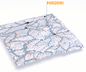 Places with similar names to P'ungni-ri, Korea, North ::
// Punganūru (IN)
// Paengno-ri (KP)
// Pongnae-ri (KP)
// Pongnae-ri (KP)
// Pangnae-ri (KR)
// Pangnae-ri (KR)
// Pangnae-ri (KR)
// Pongnae-ri (KR)
Disclaimer :: Information on this page comes without warranty of any kind |
||
|
Where is P'ungni-ri? Elevation and coordinates ::
Latitude (lat): 42°57'52"N Longitude (lon): 129°53'17"E
Elevation (approx.): 95m (map arrows pan, magnifying glasses zoom) |
||
|
Visiting P'ungni-ri? Hotel/Accommodation ::
Book a hotel in P'ungni-ri Travel Guide ::
rental cars ::
car rental offers GPS waypoint ::
download a GPX waypoint (PoI) of P'ungni-ri for your GPS receiver
|
||