|
search place name
|
||
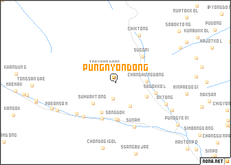
Pungnyŏn-dong (Hamgyŏng, Korea, North)Pungnyŏn-dong is a town in the Hamgyŏng region of Korea, North. An overview map of the region around Pungnyŏn-dong is displayed below.
regional and 3d topo map of Pungnyŏn-dong, Korea, North ::
Nearby towns ::
Kumsandŏgi (2.6km south) //
Taeyŏnŏ-dong (2.5km north west) //
Tŭngnyŏng-gol (4.2km south east) //
Suhwak-tong (4.4km south west) //
Changhŭng-dong (3.8km east) //
Kuŏk-tong (4.3km north east) //
Hasandal-gol (5.2km south) //
Noksaengdŏgi (4.5km south east) //
Sŏngdŏk (6.0km south) //
Sugŏri (5.3km north east) //
Ch'unhŭng-ni (6.1km south) //
T'op'odongŏgu (6.1km south) //
Sadŏk-kol (5.2km east) //
Hwasŏk-tong (6.7km south west) //
Sunam (7.5km south) //
Chungdo (7.0km south west) //
Chik-tong (8.2km north) //
Ok-tong (7.1km south east) //
[all distances 'as the bird flies' and approximate] 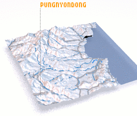 Places with similar names to Pungnyŏn-dong, Korea, North ::
// Paengnyŏn-dong (KP)
// Paengnyŏn-dong (KR)
// Paengnyŏn-dong (KR)
// P'ungnyŏn-dong (KR)
// P'ungnyŏn-dong (KP)
Disclaimer :: Information on this page comes without warranty of any kind |
||
|
Where is Pungnyŏn-dong? Elevation and coordinates ::
Latitude (lat): 41°11'51"N Longitude (lon): 129°3'56"E
Elevation (approx.): 1150m (map arrows pan, magnifying glasses zoom) |
||
|
Visiting Pungnyŏn-dong? Hotel/Accommodation ::
Book a hotel in Pungnyŏn-dong Travel Guide ::
rental cars ::
car rental offers GPS waypoint ::
download a GPX waypoint (PoI) of Pungnyŏn-dong for your GPS receiver
|
||