|
search place name
|
||
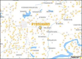
P'yŏnghwa-ri (Kaesŏng, Korea, North)P'yŏnghwa-ri is a town in the Kaesŏng region of Korea, North. An overview map of the region around P'yŏnghwa-ri is displayed below.
regional and 3d topo map of P'yŏnghwa-ri, Korea, North ::
P'yŏnghwa-ri airports ::
The nearest airport is GMP - Seoul Gimpo, located 45.9 km south of P'yŏnghwa-ri.
Other airports nearby include SSN - Seoul East Seoul Ab (70.3 km south east), OSN - Osan Ab (101.8 km south), FNJ - Pyongyang Intl (164.3 km north west), SHO - Sokch'o Sokcho (173.4 km east), Nearby towns ::
Taejojŏng-ni (0.4km south) //
Chŭngsan-dong (0.5km north west) //
Sonyŏn-dong (0.8km north) //
Yul-tong (0.9km south) //
Songgong-ni (1.1km east) //
Sae-mal (1.3km west) //
Kodusal-li (1.3km west) //
P'alchach'ŏng-dong (1.8km north) //
P'anmunjŏm-ni (1.8km south) //
Pong-dong (1.5km south west) //
Ch'ŏngdam-dong (1.8km south west) //
Kijŏng-dong (2.0km south) //
Kwangi-gol (2.1km north east) //
Paektongŭm-ni (2.5km south east) //
Chŏkch'ŏn-ni (2.5km south east) //
Ch'wijŏkkyo (2.3km north west) //
Hanae-dong (2.6km south west) //
Palsan-ni (2.6km east) //
Chŏm-maŭl (2.9km north east) //
Pŏptangbang (3.1km north west) //
Taesagogae (3.3km north west) //
Chŏnjae-ri (3.6km north east) //
T'andong-ni (3.1km west) //
P'anmun-ŭp (3.3km south west) //
Pongdong-ni (3.4km west) //
Yongdum-dong (4.0km north west) //
Oya-dong (4.4km north) //
Wanggong-dong (3.7km south west) //
Mich'on-gol (4.5km south) //
[all distances 'as the bird flies' and approximate] 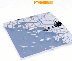 Places with similar names to P'yŏnghwa-ri, Korea, North ::
// P'yŏnghwa-ri (KP)
// P'yŏnghwa-ri (KP)
// P'yŏnghwa-ri (KP)
// P'yŏnghwa-ri (KP)
// P'yŏnghwa-ri (KP)
// P'yŏnghwa-ri (KP)
// P'yŏnghwa-ri (KP)
// P'yŏnghwa-ri (KR)
// P'yŏnghwa-ri (KP)
// P'yŏnghwa-ri (KP)
Disclaimer :: Information on this page comes without warranty of any kind |
||
|
Where is P'yŏnghwa-ri? Elevation and coordinates ::
Latitude (lat): 37°57'12"N Longitude (lon): 126°38'16"E
Elevation (approx.): 29m (map arrows pan, magnifying glasses zoom) |
||
|
Visiting P'yŏnghwa-ri? Hotel/Accommodation ::
Book a hotel in P'yŏnghwa-ri Travel Guide ::
rental cars ::
car rental offers GPS waypoint ::
download a GPX waypoint (PoI) of P'yŏnghwa-ri for your GPS receiver
|
||