|
search place name
|
||
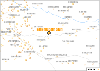
Saengdongga (Hwanghae, Korea, North)Saengdongga is a town in the Hwanghae region of Korea, North. An overview map of the region around Saengdongga is displayed below.
regional and 3d topo map of Saengdongga, Korea, North ::
Saengdongga airports ::
The nearest airport is FNJ - Pyongyang Intl, located 71.7 km north west of Saengdongga.
Other airports nearby include GMP - Seoul Gimpo (149.4 km south), SSN - Seoul East Seoul Ab (170.5 km south east), OSN - Osan Ab (205.1 km south), Nearby towns ::
Saenggŭm-ni (1.2km south) //
Ihwa-dong (3.5km south west) //
Oktŏng-ni (4.2km north west) //
Sillang-ni (5.2km south) //
Nojŏn-dong (5.5km north east) //
Tokpau (5.2km west) //
Wŏnji-dong (6.4km south west) //
Ach'ŏn-dong (6.0km north west) //
Ch'ilsŏngdae (6.1km south east) //
Sŏkhyŏl-li (5.9km east) //
Toch'i-ri (7.0km south west) //
P'yŏngjiwŏn (6.7km south west) //
Sinjong-ni (7.8km south west) //
Siriwŏl-li (7.3km south west) //
Namjŏng-nodongjagu (8.3km south) //
Changbok-tong (6.8km west) //
Taeryong-ni (7.2km north west) //
Yang'gong-ni (7.2km south west) //
Yongdu-ri (7.6km north west) //
Tŏgam-ni (8.3km north east) //
Nŭngp'a (8.3km north east) //
Wŏnch'ang (8.3km south west) //
Siksong (8.4km north west) //
Oedae-dong (9.5km north east) //
Kanjang (9.2km north west) //
Choam-dong (9.1km south west) //
Wa-dong (8.9km north west) //
Sujae-ri (9.7km south west) //
Chŏm-ch'on (10.4km south west) //
[all distances 'as the bird flies' and approximate] 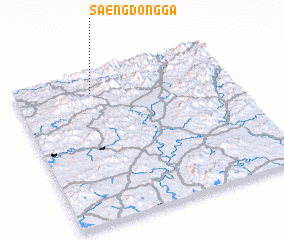 Places with similar names to Saengdongga, Korea, North ::
// Sangadaung (MM)
// Sa-ngawdung (MM)
// Sina Gahtawng (MM)
// Sungai Tinggi (MY)
// Sungai Udang (MY)
// Singatanga (BF)
// Songotongo (GT)
// Sungaitengah (ID)
// Sungaiudang (ID)
// Sangatanga (GA)
Disclaimer :: Information on this page comes without warranty of any kind |
||
|
Where is Saengdongga? Elevation and coordinates ::
Latitude (lat): 38°51'36"N Longitude (lon): 126°21'17"E
Elevation (approx.): 192m (map arrows pan, magnifying glasses zoom) |
||
|
Visiting Saengdongga? Hotel/Accommodation ::
Book a hotel in Saengdongga Travel Guide ::
rental cars ::
car rental offers GPS waypoint ::
download a GPX waypoint (PoI) of Saengdongga for your GPS receiver
|
||