|
search place name
|
||
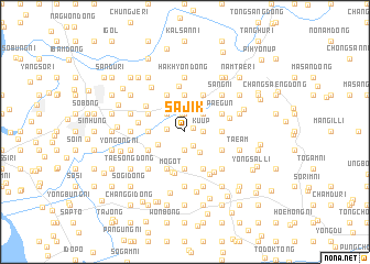
Sajik (Korea, North)Sajik is a town in Korea, North. An overview map of the region around Sajik is displayed below.
regional and 3d topo map of Sajik, Korea, North ::
Sajik airports ::
The nearest airport is FNJ - Pyongyang Intl, located 125.5 km south east of Sajik.
Nearby towns ::
Tongbu-dong (0.8km north east) //
Nae-dong (1.6km south east) //
Ponghŭng (1.4km west) //
Miryŏng-ni (1.9km north) //
Kuŭp (1.4km east) //
Pansong (1.9km south) //
Sŏngdong-ni (1.9km north) //
Pan'gong-ni (2.4km south east) //
Tŏgyang (2.3km north east) //
Tongbŏp (2.3km north west) //
Okchŏn (2.5km south west) //
Hangnyŏng-dong (3.7km north) //
Wŏnhak (3.7km north) //
Sinhak (3.7km north) //
Samin-dong (2.8km west) //
Tongmun (3.7km south) //
Namsanmu (3.7km south) //
Wŏnsan (3.7km south) //
Sŏsaryŏng (2.8km east) //
Tonghŭng (2.8km east) //
Wŏnbŏp (3.4km north west) //
Hwasan (3.4km south west) //
Sae-maŭl (4.0km north) //
Pukhak (4.0km north) //
Tangnyŏng-dong (3.4km south west) //
Arae-maŭl (4.0km north) //
Tongdang-dong (4.0km south) //
T'osŏng (4.0km south) //
Paegun (3.4km north east) //
[all distances 'as the bird flies' and approximate] 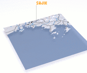 Places with similar names to Sajik, Korea, North ::
Disclaimer :: Information on this page comes without warranty of any kind |
||
|
Where is Sajik? Elevation and coordinates ::
Latitude (lat): 39°57'0"N Longitude (lon): 124°33'0"E
Elevation (approx.): 115m (map arrows pan, magnifying glasses zoom) |
||
|
Visiting Sajik? Hotel/Accommodation ::
Book a hotel in Sajik Travel Guide ::
rental cars ::
car rental offers GPS waypoint ::
download a GPX waypoint (PoI) of Sajik for your GPS receiver
|
||