|
search place name
|
||
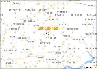
Samgwang-ni (P'yŏngan, Korea, North)Samgwang-ni is a town in the P'yŏngan region of Korea, North. An overview map of the region around Samgwang-ni is displayed below.
regional and 3d topo map of Samgwang-ni, Korea, North ::
Samgwang-ni airports ::
The nearest airport is FNJ - Pyongyang Intl, located 62.7 km south of Samgwang-ni.
Nearby towns ::
Chunggam-ni (0.7km north) //
Kwangil-li (0.9km south) //
Songsang-dong (1.3km south west) //
Kwangwŏn-ni (1.4km west) //
Sanggam-ni (1.7km east) //
Hagam-ni (2.5km north) //
Sogwi-ri (3.0km south east) //
Sŏhŭng-ni (3.1km north west) //
Sŏ-dong (3.6km north) //
Songch'ang-dong (3.1km south west) //
Nojŏn-dong (3.7km north east) //
Sŏp'yŏng-ni (4.5km south) //
Unhŭng-dong (3.5km east) //
Kirin-ni (4.0km north west) //
Sin'gwang-ni (4.8km north) //
Masanch'am (4.8km north) //
Sinyang-ni (4.8km north west) //
Imsang-ni (5.6km north) //
Inbong-dong (4.4km west) //
Kwangsŏngil-li (4.4km east) //
Yulmong-ni (4.4km west) //
Anhŭng-ni (5.6km north) //
Sagi-ri (5.3km south west) //
Kwangsŏng-dong (4.7km north east) //
Ch'ŏngdae-ri (5.4km north east) //
Ch'wihŭng-ni (5.4km north east) //
Sinhŭng-ni (5.8km south) //
Ch'aryŏng-ni (5.1km south east) //
Pugil-li (5.1km north east) //
[all distances 'as the bird flies' and approximate] 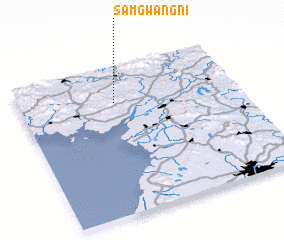 Places with similar names to Samgwang-ni, Korea, North ::
// Samgwang-ni (KR)
Disclaimer :: Information on this page comes without warranty of any kind |
||
|
Where is Samgwang-ni? Elevation and coordinates ::
Latitude (lat): 39°45'30"N Longitude (lon): 125°26'0"E
Elevation (approx.): 43m (map arrows pan, magnifying glasses zoom) |
||
|
Visiting Samgwang-ni? Hotel/Accommodation ::
Book a hotel in Samgwang-ni Travel Guide ::
rental cars ::
car rental offers GPS waypoint ::
download a GPX waypoint (PoI) of Samgwang-ni for your GPS receiver
|
||