|
search place name
|
||
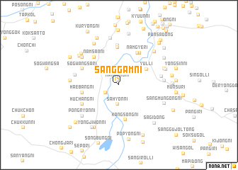
Sanggam-ni (Kangwŏn, Korea, North)Sanggam-ni is a town in the Kangwŏn region of Korea, North. An overview map of the region around Sanggam-ni is displayed below.
regional and 3d topo map of Sanggam-ni, Korea, North ::
Sanggam-ni airports ::
The nearest airport is SHO - Sokch'o Sokcho, located 133.9 km south east of Sanggam-ni.
Other airports nearby include FNJ - Pyongyang Intl (158.3 km west), GMP - Seoul Gimpo (166.6 km south), SSN - Seoul East Seoul Ab (171.0 km south), KAG - Kangnung Gangneung (185.9 km south east), Nearby towns ::
Nanjŏng-ni (0.7km north) //
Kŭmp'ung-ni (2.0km south west) //
Sahyŏn-ni (3.0km south) //
Chungŏji-ri (3.5km north east) //
Yul-li (4.2km north east) //
Kangsŏng-ni (5.5km south) //
Namgye-ri (5.5km north east) //
Namsanyŏng-ni (5.4km north west) //
Namsan-ni (5.4km north west) //
Haebang-ni (4.7km west) //
Kŭm-ni (5.9km north) //
Chojŏl-li (5.6km north east) //
Ch'onŭp (6.2km north) //
Sŏgwangsa-ri (5.2km north west) //
P'yŏnghwa-ri (5.2km north west) //
Huch'ang-ni (5.4km south west) //
Sŏkpyŏl-li (5.4km east) //
Osan-ni (5.6km west) //
Sunam-ni (5.6km east) //
Sinhyŏn-ni (6.3km north west) //
Chuŭm-ni (7.5km north) //
Kunam-ni (7.1km north west) //
Tongha-ri (6.6km south west) //
Pongnyŏn-ni (6.6km south west) //
Sinhwa-ri (6.1km north east) //
Sangmun'gong-ni (6.3km south east) //
Nungbong-ni (6.0km west) //
Il-tong (6.8km north east) //
Sinch'ŏng-ni (6.6km north west) //
[all distances 'as the bird flies' and approximate] 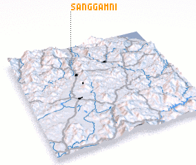 Places with similar names to Sanggam-ni, Korea, North ::
// Sangamon (US)
// Ciénaga Mono (PA)
// Sung Men (TH)
// Zinkumbini (ZA)
// Sungaiman (ID)
// Sungaimanau (ID)
// Sungaimanau (ID)
// Sunggumanai (ID)
// Sāng Miāni (PK)
// Sankaman (GN)
Disclaimer :: Information on this page comes without warranty of any kind |
||
|
Where is Sanggam-ni? Elevation and coordinates ::
Latitude (lat): 38°57'38"N Longitude (lon): 127°28'8"E
Elevation (approx.): 102m (map arrows pan, magnifying glasses zoom) |
||
|
Visiting Sanggam-ni? Hotel/Accommodation ::
Book a hotel in Sanggam-ni Travel Guide ::
rental cars ::
car rental offers GPS waypoint ::
download a GPX waypoint (PoI) of Sanggam-ni for your GPS receiver
|
||