|
search place name
|
||
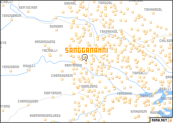
Sangganam-ni (Hamgyŏng, Korea, North)Sangganam-ni is a town in the Hamgyŏng region of Korea, North. An overview map of the region around Sangganam-ni is displayed below.
regional and 3d topo map of Sangganam-ni, Korea, North ::
Sangganam-ni airports ::
The nearest airport is FNJ - Pyongyang Intl, located 137.2 km west of Sangganam-ni.
Other airports nearby include SHO - Sokch'o Sokcho (189.2 km south east), GMP - Seoul Gimpo (215.5 km south), KAG - Kangnung Gangneung (241.9 km south east), Nearby towns ::
Kol-mal (0.4km south) //
Ch'ang-dong (0.8km north west) //
Kunnae-ri (1.0km south east) //
Haganam-ni (1.2km east) //
Hasach'ang-ni (1.3km north west) //
Songmol-tong (1.3km north east) //
Tongyang-ni (1.6km south) //
Kŭmch'ang-ni (1.6km north east) //
Kadongsal-li (1.7km south east) //
Hyŏnhung-ni (1.9km north) //
Kolnae-dong (1.7km north west) //
Kaha-ri (2.0km south east) //
Pukpangch'ung-ni (2.2km south) //
Tŏkhŭng-ni (2.7km south) //
Tŏkchi-ri (2.1km west) //
Puraesal-lodongjagu (2.3km south west) //
Sil-li (2.7km south) //
Hagoŭn-ni (2.7km north west) //
Kŭmsu-ri (2.2km west) //
Yŏndang (2.3km south east) //
Taesugong-ni (2.2km west) //
Sangsach'ang-ni (2.3km north west) //
Nammang-gol (2.3km east) //
Tŏkchi (2.6km south east) //
Sŏdang-ni (2.7km north east) //
Namyang-ni (2.7km south west) //
Sinhŭng-ni (2.7km north east) //
Sinsŏng-ni (3.1km south east) //
Kok-ch'on (2.8km south east) //
[all distances 'as the bird flies' and approximate] 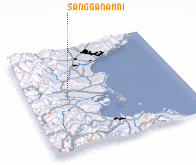 Places with similar names to Sangganam-ni, Korea, North ::
// Sangnam-ni (KP)
// Sangnim-ni (KP)
// Sŏngnam-ni (KP)
// Sŏngnam-ni (KP)
// Sŏngnam-ni (KP)
// Sŏngnam-ni (KP)
// Songnam-ni (KP)
// Songnim-ni (KP)
// Songnim-ni (KP)
// Songnim-ni (KP)
Disclaimer :: Information on this page comes without warranty of any kind |
||
|
Where is Sangganam-ni? Elevation and coordinates ::
Latitude (lat): 39°28'8"N Longitude (lon): 127°13'50"E
Elevation (approx.): 32m (map arrows pan, magnifying glasses zoom) |
||
|
Visiting Sangganam-ni? Hotel/Accommodation ::
Book a hotel in Sangganam-ni Travel Guide ::
rental cars ::
car rental offers GPS waypoint ::
download a GPX waypoint (PoI) of Sangganam-ni for your GPS receiver
|
||