|
search place name
|
||
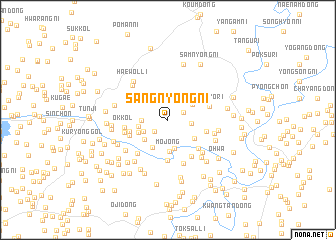
Sangnyŏng-ni (Hwanghae, Korea, North)Sangnyŏng-ni is a town in the Hwanghae region of Korea, North. An overview map of the region around Sangnyŏng-ni is displayed below.
regional and 3d topo map of Sangnyŏng-ni, Korea, North ::
Sangnyŏng-ni airports ::
The nearest airport is GMP - Seoul Gimpo, located 83.1 km south east of Sangnyŏng-ni.
Other airports nearby include SSN - Seoul East Seoul Ab (108.8 km south east), FNJ - Pyongyang Intl (126.1 km north west), OSN - Osan Ab (139.1 km south east), YEC - Yechon Yecheon (249.6 km south east), Nearby towns ::
Miram-dong (1.6km north east) //
Ch'ŏlbong-ni (1.7km south west) //
Pujŏng-ni (2.1km east) //
Chajak-kol (2.3km west) //
Changgogae (2.5km south west) //
Chinp'o-ri (2.8km north east) //
Tanp'o-ri (2.7km north east) //
Chegung-ni (3.2km south) //
Sallo-gol (2.7km west) //
Tolta-ri (3.0km south west) //
Hambak-kol (3.3km south west) //
Mojŏng (3.5km south) //
Sŏnbau (3.0km south west) //
Man'gajong (3.1km south east) //
Sagi-gol (3.6km west) //
Horyong-gol (4.5km south) //
P'iltaerisatŏ (3.6km east) //
Pongt'al-li (3.8km south west) //
Wagarhyŏn (4.2km south east) //
Kongbau (4.6km south east) //
Ok-kol (3.9km west) //
Taegyo-ri (4.0km north east) //
Chaehyŏn (4.0km west) //
Chŏkp'o (4.6km south west) //
Nungmal (5.0km south) //
Yongch'ŏl-li (4.7km south east) //
Yonggung-ni (4.3km east) //
Sap'anjae (4.9km north west) //
Ibam (5.1km south east) //
[all distances 'as the bird flies' and approximate] 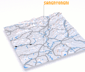 Places with similar names to Sangnyŏng-ni, Korea, North ::
// Sangnyŏng-ni (KP)
// Sangnyong-ni (KP)
// Sangnyung-ni (KP)
// Sangnyung-ni (KP)
// Songnyŏng-ni (KP)
// Ssangnyong-ni (KP)
// Ssangnyong-ni (KP)
// Ssangnyong-ni (KP)
// Ssangnyong-ni (KP)
// Ssangnyong-ni (KP)
Disclaimer :: Information on this page comes without warranty of any kind |
||
|
Where is Sangnyŏng-ni? Elevation and coordinates ::
Latitude (lat): 38°13'40"N Longitude (lon): 126°22'4"E
Elevation (approx.): 78m (map arrows pan, magnifying glasses zoom) |
||
|
Visiting Sangnyŏng-ni? Hotel/Accommodation ::
Book a hotel in Sangnyŏng-ni Travel Guide ::
rental cars ::
car rental offers GPS waypoint ::
download a GPX waypoint (PoI) of Sangnyŏng-ni for your GPS receiver
|
||