|
search place name
|
||
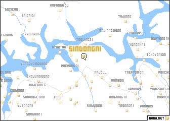
Sindŏng-ni (Korea, North)Sindŏng-ni is a town in Korea, North. An overview map of the region around Sindŏng-ni is displayed below.
regional and 3d topo map of Sindŏng-ni, Korea, North ::
Sindŏng-ni airports ::
The nearest airport is FNJ - Pyongyang Intl, located 157.3 km south of Sindŏng-ni.
Nearby towns ::
Songi-ri (1.4km west) //
Nohyang-ni (2.6km north west) //
Pyŏktong-ŭp (3.4km south) //
Yaolingzi (3.6km north) //
Paep'ung-ni (3.3km south west) //
Songjang-ni (4.8km south) //
Ch'angsang-ni (5.0km south) //
Majŏl-li (4.7km south east) //
Songsa-ri (5.7km south) //
Ch'ŏn-dong (5.7km south) //
Pyŏktan (4.6km north west) //
Myŏngsan-ni (6.1km south) //
Poch'ang-ni (6.6km south west) //
Monjianghong (7.0km north east) //
Irhŭng-ni (7.0km south east) //
Wanjung-ni (8.9km south) //
Namsŏ-ri (7.9km south east) //
Songsan-ni (7.9km south east) //
Ch'osang-ni (8.5km south west) //
[all distances 'as the bird flies' and approximate] 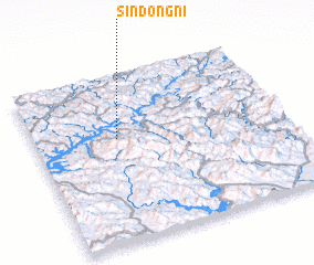 Places with similar names to Sindŏng-ni, Korea, North ::
// Sindangan (ID)
// Sientankine (SN)
// Sindangana (ZM)
// Sandang-ni (KP)
// Sandong-ni (KP)
// Sindang-ni (KP)
// Sindang-ni (KP)
// Sindang-ni (KP)
// Sindang-ni (KP)
// Sindang-ni (KP)
Disclaimer :: Information on this page comes without warranty of any kind |
||
|
Where is Sindŏng-ni? Elevation and coordinates ::
Latitude (lat): 40°37'0"N Longitude (lon): 125°20'0"E
Elevation (approx.): 321m (map arrows pan, magnifying glasses zoom) |
||
|
Visiting Sindŏng-ni? Hotel/Accommodation ::
Book a hotel in Sindŏng-ni Travel Guide ::
rental cars ::
car rental offers GPS waypoint ::
download a GPX waypoint (PoI) of Sindŏng-ni for your GPS receiver
|
||