|
search place name
|
||
Sirubongdŏgi (Hamgyŏng, Korea, North)Sirubongdŏgi is a town in the Hamgyŏng region of Korea, North. An overview map of the region around Sirubongdŏgi is displayed below.
regional and 3d topo map of Sirubongdŏgi, Korea, North ::
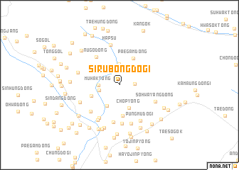
Nearby towns ::
K'ŭnhwayang-gol (1.8km east) //
Yangch'ŏn-dong (2.5km west) //
Muhak-tong (2.5km west) //
Kanjidongŏgu (3.3km north) //
Sirubong (3.3km north west) //
Taehŭng 2-dong (3.6km south west) //
Ch'op'yŏng (3.8km south) //
Paegam-dong (4.4km north) //
Chagŭntalmedŏgi (3.8km south west) //
Tŭrŭng-gol (4.8km south) //
Nugŏ-dong (5.2km north west) //
Sunch'idŏgi (5.9km south) //
Taesil-li (6.1km south) //
Taehŭng 1-tong (5.7km south west) //
Sohwayang-dong (5.0km south east) //
Wŏlsandŏgi (5.4km south west) //
Saemdŏgi (6.2km south) //
Ch'angp'yŏng (6.1km south west) //
P'ungmudŏgi (6.1km south east) //
Hapsu (6.4km north) //
Taegaek-ch'on (5.4km south west) //
Namjŏlsu (5.4km west) //
Ahŭn-gol (6.9km south) //
Taesin-dong (7.2km south) //
Sŏng-dong (7.2km south) //
K'ŭn-mal (7.4km south) //
Sinbokchang (7.7km south) //
Sŏjae-ch'on (7.8km south) //
Tokchang-gol (5.9km west) //
[all distances 'as the bird flies' and approximate] 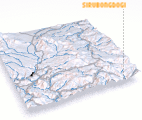 Places with similar names to Sirubongdŏgi, Korea, North :: Disclaimer :: Information on this page comes without warranty of any kind |
||
|
Where is Sirubongdŏgi? Elevation and coordinates ::
Latitude (lat): 41°4'25"N Longitude (lon): 128°52'59"E
Elevation (approx.): 1445m (map arrows pan, magnifying glasses zoom) |
||
|
Visiting Sirubongdŏgi? Hotel/Accommodation ::
Book a hotel in Sirubongdŏgi Travel Guide ::
rental cars ::
car rental offers GPS waypoint ::
download a GPX waypoint (PoI) of Sirubongdŏgi for your GPS receiver
|
||