|
search place name
|
||
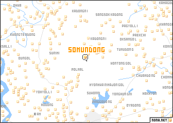
Sŏmun-dong (Kaesŏng, Korea, North)Sŏmun-dong is a town in the Kaesŏng region of Korea, North. An overview map of the region around Sŏmun-dong is displayed below.
regional and 3d topo map of Sŏmun-dong, Korea, North ::
Sŏmun-dong airports ::
The nearest airport is GMP - Seoul Gimpo, located 62.5 km south of Sŏmun-dong.
Other airports nearby include SSN - Seoul East Seoul Ab (86.9 km south east), OSN - Osan Ab (118.6 km south), FNJ - Pyongyang Intl (147.5 km north west), YEC - Yechon Yecheon (227.3 km south east), Nearby towns ::
Hajŏngja-dong (1.6km north) //
Manemi (2.2km north) //
Sansŏng-ni (2.6km north east) //
Pagyŏl-li (2.7km north east) //
Pŏlmal (3.2km south west) //
Kigok-tong (3.4km north) //
Habaeksŏk-kol (2.9km east) //
Wŏndang-gol (3.8km north) //
Pŏlgogae (3.8km south west) //
Sangpaeksŏk-kol (3.5km north east) //
Wŏnjŏk-kol (4.5km south) //
Kadŏng-ni (4.4km north east) //
Tŏkchŏk-kol (5.1km north) //
Sŏje-dong (5.0km south west) //
Samp'o-dong (5.4km south) //
Changsirang (4.6km north east) //
Sŏnmun-dong (5.7km south) //
Ŭmt'ŏ-gol (5.5km south west) //
Mayu-dong (5.2km south west) //
Samgŏ-ri (6.2km south west) //
Paenŭng-gol (5.6km north east) //
Simch'ŏllimajŏn-gol (6.0km south west) //
Surimi (5.5km west) //
Yangham-ni (6.6km north) //
Sangwang-dong (6.0km north west) //
Chin'gogae (6.8km south) //
Ch'ŏngsŏk-kol (6.8km south west) //
Hyŏnhwarimajŏn-gol (7.2km south east) //
Wŏnt'ong-gol (6.2km east) //
[all distances 'as the bird flies' and approximate] 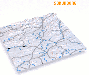 Places with similar names to Sŏmun-dong, Korea, North ::
// Samundengo (CD)
// Cimenteng (ID)
// Cimenteng (ID)
// Semanding (ID)
// Simintang (GA)
// Samin-dong (KP)
// Simun-dong (KP)
// Somnae-dong (KP)
// Sŏmun-dong (KP)
// Sumun-dong (KP)
Disclaimer :: Information on this page comes without warranty of any kind |
||
|
Where is Sŏmun-dong? Elevation and coordinates ::
Latitude (lat): 38°5'20"N Longitude (lon): 126°33'5"E
Elevation (approx.): 169m (map arrows pan, magnifying glasses zoom) |
||
|
Visiting Sŏmun-dong? Hotel/Accommodation ::
Book a hotel in Sŏmun-dong Travel Guide ::
rental cars ::
car rental offers GPS waypoint ::
download a GPX waypoint (PoI) of Sŏmun-dong for your GPS receiver
|
||