|
search place name
|
||
Songbong-ni (Hwanghae, Korea, North)Songbong-ni is a town in the Hwanghae region of Korea, North. An overview map of the region around Songbong-ni is displayed below.
regional and 3d topo map of Songbong-ni, Korea, North ::

Songbong-ni airports ::
The nearest airport is FNJ - Pyongyang Intl, located 70.7 km north of Songbong-ni.
Other airports nearby include GMP - Seoul Gimpo (171.5 km south east), SSN - Seoul East Seoul Ab (201.0 km south east), OSN - Osan Ab (224.1 km south east), Nearby towns ::
Songno-dong (0.3km north west) //
Hanbong-ni (0.8km south east) //
Taeŏk-tong (1.1km south west) //
Soŏk-tong (1.2km south west) //
Tangjŏ-dong (1.8km north) //
Sa-ri (1.7km south west) //
Angwŏl-tong (2.5km south) //
Unbong-dong (2.3km north east) //
Wŏnsinch'on (2.2km south west) //
Sangsaenggŭn (2.7km north west) //
P'ogŏ-ri (2.5km west) //
Tangnimch'on (2.7km south west) //
Saenggul-li (3.4km north) //
Songhak-tong (3.3km north east) //
Kyoha-dong (3.6km north) //
T'an-dong (3.0km south west) //
Yangdam-ni (3.0km north west) //
Hasaenggŭn (3.7km north) //
Sanch'on (3.1km east) //
Namsal-li (3.8km north east) //
Kwanhae-ri (3.8km west) //
Yanggok-tong (4.1km south west) //
Ihwach'on (4.7km north west) //
Ch'ang-dong (4.3km north east) //
Sasong-dong (4.6km south east) //
Chŏksu-dong (4.5km south east) //
Nuch'on (4.5km south west) //
Ch'angha-dong (4.9km north east) //
Kulsal-li (4.4km north east) //
[all distances 'as the bird flies' and approximate] 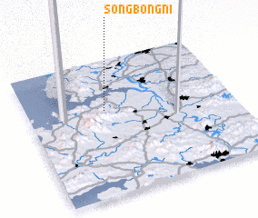 Places with similar names to Songbong-ni, Korea, North ::
// Sangbang-ni (KP)
// Sangbong-ni (KP)
// Sangbong-ni (KP)
// Songbong-ni (KP)
// Sŏngbung-ni (KP)
// Sŏngbung-ni (KP)
// Sŏngbung-ni (KP)
// Sŏngbung-ni (KP)
// Sŏngbung-ni (KP)
// Sŏngbung-ni (KP)
Disclaimer :: Information on this page comes without warranty of any kind |
||
|
Where is Songbong-ni? Elevation and coordinates ::
Latitude (lat): 38°37'43"N Longitude (lon): 125°22'47"E
Elevation (approx.): 19m (map arrows pan, magnifying glasses zoom) |
||
|
Visiting Songbong-ni? Hotel/Accommodation ::
Book a hotel in Songbong-ni Travel Guide ::
rental cars ::
car rental offers GPS waypoint ::
download a GPX waypoint (PoI) of Songbong-ni for your GPS receiver
|
||