|
search place name
|
||
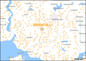
Songhyŏl-li (Kaesŏng, Korea, North)Songhyŏl-li is a town in the Kaesŏng region of Korea, North. An overview map of the region around Songhyŏl-li is displayed below.
regional and 3d topo map of Songhyŏl-li, Korea, North ::
Songhyŏl-li airports ::
The nearest airport is GMP - Seoul Gimpo, located 46.9 km south east of Songhyŏl-li.
Other airports nearby include SSN - Seoul East Seoul Ab (74.4 km south east), OSN - Osan Ab (102.7 km south east), FNJ - Pyongyang Intl (162.4 km north west), YEC - Yechon Yecheon (216.7 km south east), Nearby towns ::
Usan-dong (0.6km north east) //
Pakchŏk-tong (0.7km west) //
Pusan-dong (0.8km south west) //
Moch'im-dong (0.9km south east) //
Nae-dong (1.1km south) //
Kŭmam-dong (0.9km north west) //
Kwangch'ŏl-li (1.3km north) //
Ch'ŏnbang-dong (1.7km south) //
Mongnyŏn-gol (1.7km south east) //
Wŏnsan (1.6km north east) //
Kan-dong (2.0km north) //
Yŏsŏk-tong (1.7km east) //
Ongnyŏn-gol (1.9km north west) //
Samjwarang-dong (2.1km east) //
Kwangdam-ni (2.6km north) //
Yunch'on-dong (2.6km south) //
Ch'ongnŭng-dong (2.3km north east) //
Cheryang-dong (2.7km north west) //
Taehŭng-dong (2.4km south east) //
Paekch'on-dong (2.9km south) //
Osal-li (2.4km east) //
Kung-gol (3.1km south) //
Kosan-dong (2.6km south west) //
Hongch'on-dong (3.1km south) //
Yŏndong-ni (3.2km south east) //
Kangnŭng-dong (2.9km north east) //
Idap-tong (3.5km north) //
Tongmak (3.2km south east) //
Muksong-ni (3.2km south west) //
[all distances 'as the bird flies' and approximate] 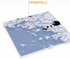 Places with similar names to Songhyŏl-li, Korea, North ::
// Sŏnghyŏl-li (KP)
// Sŏnghyŏl-li (KP)
// Sŏnghyŏl-li (KP)
// Songhyŏl-li (KP)
// Songhyŏl-li (KP)
// Songhyŏl-li (KP)
// Songhyŏl-li (KP)
// Songhyŏl-li (KP)
// Songhyŏl-li (KP)
// Songhyŏl-li (KP)
Disclaimer :: Information on this page comes without warranty of any kind |
||
|
Where is Songhyŏl-li? Elevation and coordinates ::
Latitude (lat): 37°55'23"N Longitude (lon): 126°31'18"E
Elevation (approx.): 45m (map arrows pan, magnifying glasses zoom) |
||
|
Visiting Songhyŏl-li? Hotel/Accommodation ::
Book a hotel in Songhyŏl-li Travel Guide ::
rental cars ::
car rental offers GPS waypoint ::
download a GPX waypoint (PoI) of Songhyŏl-li for your GPS receiver
|
||