|
search place name
|
||
Songjŏng-dong (Hwanghae, Korea, North)Songjŏng-dong is a town in the Hwanghae region of Korea, North. An overview map of the region around Songjŏng-dong is displayed below.
regional and 3d topo map of Songjŏng-dong, Korea, North ::

Songjŏng-dong airports ::
The nearest airport is GMP - Seoul Gimpo, located 102.0 km south east of Songjŏng-dong.
Other airports nearby include FNJ - Pyongyang Intl (107.4 km north west), SSN - Seoul East Seoul Ab (127.2 km south east), OSN - Osan Ab (158.0 km south east), Nearby towns ::
Palch'am-ni (0.6km south west) //
Chusŏng-dong (0.8km south west) //
Chŏndŭl (1.0km north) //
Yuch'ŏl-li (1.4km south) //
Kwandae-dong (1.7km south west) //
Samch'ŏn-ni (2.3km south) //
Yuch'ŏn-ni (2.4km south east) //
Tunjŏl-gol (2.6km south west) //
Tangil-li (2.8km south west) //
Ch'omok-tong (2.6km west) //
Yangch'ol-li (2.8km west) //
Chŏngmun-dong (3.6km north) //
Ch'ŏnghang-nodongjagu (3.1km south east) //
Yangam-ni (3.0km west) //
Soeul (3.5km south west) //
Ch'ang-mal (3.6km south west) //
Nang-dong (3.9km north) //
Sosok-tong (3.7km north west) //
Umch'on-dong (3.6km south west) //
Mulgae-ri (3.4km east) //
Soksil-li (4.3km north) //
Tŏkpau (4.0km south west) //
Chubong-dong (3.9km north west) //
Mayu-ri (4.8km south) //
Tŏgam-ni (4.3km south west) //
Taesok-tong (4.8km north west) //
Yangsa-ri (5.2km north) //
Ch'ŏngp'o-ri (5.3km north) //
Yangji-ri (5.4km north) //
[all distances 'as the bird flies' and approximate] 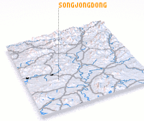 Places with similar names to Songjŏng-dong, Korea, North ::
// Sangjang-dong (KP)
// Sangjang-dong (KP)
// Sangjang-dong (KP)
// Sangjang-dong (KP)
// Sangjŏng-dong (KP)
// Sangjŭng-dong (KP)
// Sangjung-dong (KP)
// Sŏngjang-dong (KP)
// Songjŏng-dong (KP)
// Songjŏng-dong (KP)
Disclaimer :: Information on this page comes without warranty of any kind |
||
|
Where is Songjŏng-dong? Elevation and coordinates ::
Latitude (lat): 38°23'12"N Longitude (lon): 126°17'20"E
Elevation (approx.): 90m (map arrows pan, magnifying glasses zoom) |
||
|
Visiting Songjŏng-dong? Hotel/Accommodation ::
Book a hotel in Songjŏng-dong Travel Guide ::
rental cars ::
car rental offers GPS waypoint ::
download a GPX waypoint (PoI) of Songjŏng-dong for your GPS receiver
|
||