|
search place name
|
||
Songŏjik (Hamgyŏng, Korea, North)Songŏjik is a town in the Hamgyŏng region of Korea, North. An overview map of the region around Songŏjik is displayed below.
regional and 3d topo map of Songŏjik, Korea, North ::
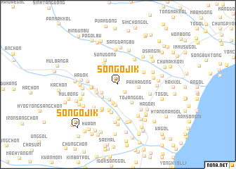
Nearby towns ::
Kosarip'yŏng (1.5km south east) //
Kallim (2.6km south west) //
Hoe-gol (2.4km south west) //
Tongyŏk-kol (3.1km south) //
T'ŏ-gol (2.7km south west) //
Sae-mal (3.2km south) //
Suryugol (3.3km south) //
Pakha-dong (2.5km east) //
Yukhyangdongŭmji (2.8km south west) //
Tangu-ch'on (2.7km west) //
Tojang-gol (3.4km south east) //
Noambu (3.6km north west) //
Chuŭronbo-ri (3.1km west) //
Sunu-dong (4.1km north) //
Sagyep'yŏng (3.3km west) //
Sap'yŏng (4.2km south) //
Chaebong-gol (3.6km north east) //
An'gandŏk (4.3km south west) //
Sangch'on (4.6km south) //
Hoe-gol (4.3km north east) //
Sangonp'o-ri (3.6km west) //
Yongsal-li (4.6km south west) //
Tokkumigi-mal (4.6km south west) //
Saenggiryŏng-nodongjagu (4.2km south east) //
Haonp'o-ri (5.4km south) //
Noyabu (5.4km north) //
Ŏjaeng-gol (4.9km south east) //
Sŏŭi-gol (4.2km west) //
Yongambu (5.5km north) //
[all distances 'as the bird flies' and approximate] 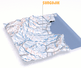 Places with similar names to Songŏjik, Korea, North ::
// Sangu Jack (ZM)
// Sŏngjik (KP)
// Songŏjik (KP)
// Sangjagae (KR)
// Sangjak (KR)
// Sangjŏk (KR)
// Sangjuk (KR)
// Sangjuk (KR)
// Songjiakou (CN)
// Songjiagou (CN)
Disclaimer :: Information on this page comes without warranty of any kind |
||
|
Where is Songŏjik? Elevation and coordinates ::
Latitude (lat): 41°39'16"N Longitude (lon): 129°34'13"E
Elevation (approx.): 135m (map arrows pan, magnifying glasses zoom) |
||
|
Visiting Songŏjik? Hotel/Accommodation ::
Book a hotel in Songŏjik Travel Guide ::
rental cars ::
car rental offers GPS waypoint ::
download a GPX waypoint (PoI) of Songŏjik for your GPS receiver
|
||