|
search place name
|
||
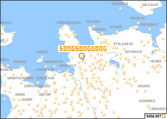
Songsŏng-dong (Hwanghae, Korea, North)Songsŏng-dong is a town in the Hwanghae region of Korea, North. An overview map of the region around Songsŏng-dong is displayed below.
regional and 3d topo map of Songsŏng-dong, Korea, North ::
Songsŏng-dong airports ::
The nearest airport is FNJ - Pyongyang Intl, located 82.5 km north east of Songsŏng-dong.
Other airports nearby include GMP - Seoul Gimpo (183.8 km south east), SSN - Seoul East Seoul Ab (214.0 km south east), OSN - Osan Ab (234.7 km south east), Nearby towns ::
Ch'ŏlsal-li (0.3km south west) //
Kohyŏl-li (0.4km north west) //
Chŭngsŏng-dong (0.6km south) //
Munbong-ch'on (0.7km north) //
Haep'yŏng-ch'on (1.0km south west) //
Kŭmsan-ni (1.8km south west) //
Paek-tong (1.6km north east) //
Nŭk-tong (2.0km north) //
Sinijong (1.8km south east) //
Kŭmsanp'o-rodongjagu (2.1km south) //
Idop'o-ri (2.1km north east) //
Araegandam-dong (1.9km south east) //
Kang-ch'on (2.3km south) //
Kansan-ch'on (2.0km east) //
Yangch'ŏn-dong (2.1km west) //
Nong-ch'on (2.8km south east) //
Kuijŏng (2.4km east) //
Yŏm-ch'on (2.8km north east) //
Waryŏng-ni (3.1km south) //
Sai-ri (2.7km south east) //
Unjŏl-li (2.8km north west) //
Pae-ch'on (3.4km south) //
Hagamjŏng (2.8km north east) //
Chunggandam-dong (2.7km east) //
Sŏhae-ri (3.5km north) //
Ora-ri (3.3km north west) //
Wŏllae-dong (3.4km north east) //
Yonghyŏn (3.3km south east) //
Ki-dong (3.9km north) //
[all distances 'as the bird flies' and approximate] 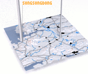 Places with similar names to Songsŏng-dong, Korea, North ::
// Sangsang-dong (KP)
// Sangsang-dong (KP)
// Sangsŏng-dong (KP)
// Sangsŏng-dong (KP)
// Sangsong-dong (KP)
// Sangsong-dong (KP)
// Sangsŭng-dong (KP)
// Songsang-dong (KP)
// Songsŏng-dong (KP)
// Songsŏng-dong (KP)
Disclaimer :: Information on this page comes without warranty of any kind |
||
|
Where is Songsŏng-dong? Elevation and coordinates ::
Latitude (lat): 38°35'51"N Longitude (lon): 125°9'32"E
Elevation (approx.): 12m (map arrows pan, magnifying glasses zoom) |
||
|
Visiting Songsŏng-dong? Hotel/Accommodation ::
Book a hotel in Songsŏng-dong Travel Guide ::
rental cars ::
car rental offers GPS waypoint ::
download a GPX waypoint (PoI) of Songsŏng-dong for your GPS receiver
|
||