|
search place name
|
||
Taebinp'o (Korea, North)Taebinp'o is a town in Korea, North. An overview map of the region around Taebinp'o is displayed below.
regional and 3d topo map of Taebinp'o, Korea, North ::

Taebinp'o airports ::
The nearest airport is FNJ - Pyongyang Intl, located 97.2 km south east of Taebinp'o.
Nearby towns ::
Nam-dong (0.0km north) //
Ansal-li (0.9km north east) //
Tong-dong (1.4km east) //
Hangnim-dong (1.4km east) //
Tang-dong (1.4km east) //
Sŏ-dong (1.9km north) //
Hakhyŏn-dong (1.9km north) //
Yongam-dong (2.3km south west) //
Naeam-dong (2.2km south west) //
Hakhyŏndong-Ha-dong (3.4km north) //
Kwang-dong (3.7km north) //
Sago-dong (3.7km north) //
Tŏkbawi (2.8km west) //
Ch'ongsong-ni (3.8km north) //
Ch'uam (3.1km east) //
Ch'ŏn-dong (4.0km north) //
Songjŏng-dong (4.0km north) //
Hadan (4.0km north) //
Subu-ri (3.2km west) //
Such'ŏng-ni (3.5km east) //
Changnyŏng (3.7km east) //
Hagam (3.8km east) //
Chang-ch'on (4.7km north east) //
Sambong (4.7km north west) //
Yongbong (4.7km north west) //
Tongp'yŏng-ni (4.9km north west) //
Sogokkae (4.5km south east) //
T'ap-tong (4.3km east) //
Kŭmbong (4.3km west) //
[all distances 'as the bird flies' and approximate] 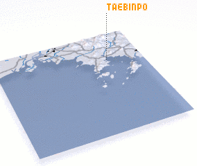 Places with similar names to Taebinp'o, Korea, North ::
// Taybina P. (RU)
Disclaimer :: Information on this page comes without warranty of any kind |
||
|
Where is Taebinp'o? Elevation and coordinates ::
Latitude (lat): 39°45'0"N Longitude (lon): 124°46'0"E
Elevation (approx.): 22m (map arrows pan, magnifying glasses zoom) |
||
|
Visiting Taebinp'o? Hotel/Accommodation ::
Book a hotel in Taebinp'o Travel Guide ::
rental cars ::
car rental offers GPS waypoint ::
download a GPX waypoint (PoI) of Taebinp'o for your GPS receiver
|
||