|
search place name
|
||
Taedŏng-nodongjagu (Yanggang, Korea, North)Taedŏng-nodongjagu is a town in the Yanggang region of Korea, North. An overview map of the region around Taedŏng-nodongjagu is displayed below.
regional and 3d topo map of Taedŏng-nodongjagu, Korea, North ::
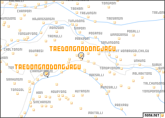
Nearby towns ::
Chijudang (0.2km west) //
Chŏlchŏm-dong (0.6km north west) //
Kuhang (1.1km south east) //
Kuryŏl-li (1.3km north west) //
Yŏnal-li (1.6km north east) //
Oesal-li (2.2km south west) //
Chunghŭng-ni (2.6km south) //
Myŏngdŏk-kol (2.2km south east) //
Sinjung-ni (2.9km south) //
Tongch'op'yŏng (2.8km north) //
Taehŭng-ni (2.2km west) //
Taemunjang (2.5km west) //
Paekp'o-ri (3.7km north) //
Pyŏllam-ni (3.0km north east) //
Holbu-ri (3.9km south west) //
Naesal-li (5.1km south east) //
Taesang-ni (4.6km south west) //
Pogansu (5.5km north east) //
Simp'o-ri (6.1km north) //
K'ŭngogaemit (4.7km east) //
Sanjin-dong (5.5km north east) //
Tongp'yŏng-ni (5.5km south east) //
Changdong-ni (6.7km south east) //
Taemul-li (6.4km north west) //
Yongch'ŏl-li (5.9km east) //
Tunji-dong (7.9km north) //
Chongp'o-ri (6.3km south east) //
Unhŭng-ŭp (6.0km east) //
Chamdong-ni (7.2km south west) //
[all distances 'as the bird flies' and approximate] 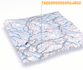 Places with similar names to Taedŏng-nodongjagu, Korea, North ::
// Taedong-nodongjagu (KP)
// Taet'aeng-nodongjagu (KP)
Disclaimer :: Information on this page comes without warranty of any kind |
||
|
Where is Taedŏng-nodongjagu? Elevation and coordinates ::
Latitude (lat): 41°18'59"N Longitude (lon): 128°23'3"E
Elevation (approx.): 1020m (map arrows pan, magnifying glasses zoom) |
||
|
Visiting Taedŏng-nodongjagu? Hotel/Accommodation ::
Book a hotel in Taedŏng-nodongjagu Travel Guide ::
rental cars ::
car rental offers GPS waypoint ::
download a GPX waypoint (PoI) of Taedŏng-nodongjagu for your GPS receiver
|
||