|
search place name
|
||
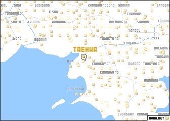
T'aehwa (Korea, North)T'aehwa is a town in Korea, North. An overview map of the region around T'aehwa is displayed below.
regional and 3d topo map of T'aehwa, Korea, North ::
T'aehwa airports ::
The nearest airport is FNJ - Pyongyang Intl, located 113.2 km south east of T'aehwa.
Nearby towns ::
Pup'yŏng-dong (0.4km south west) //
Sŏngam-ni (1.0km north east) //
Inp'yŏng-dong (1.4km south east) //
T'aebong-ni (1.5km south west) //
Songsan (1.4km east) //
Hakpong (1.4km east) //
Sin'got-tong (1.9km north) //
Ihwa-ri (1.6km south west) //
Haksal-li (1.8km south east) //
Sangp'yŏng (2.5km north) //
Hakpong (2.3km south east) //
Ipsŏk (2.7km north east) //
Ihwa (2.7km south west) //
Anp'yŏng (3.3km south east) //
Sŏn-ni (3.7km north) //
Sŏkt'an (3.7km north) //
Hwach'ŏn (2.8km east) //
Tŏkpong (2.8km east) //
Namsan (3.7km south) //
Munbong-ni (3.1km north east) //
Changhyŏn (3.4km south east) //
Hwa-dong (4.4km north) //
Kŭmsal-li (4.5km south east) //
Inhaeng (4.7km south east) //
Hakso-ri (5.1km north west) //
Tajŏng-dong (5.6km north) //
Sin-dong (4.4km east) //
Sŏkpong (5.5km south) //
Hyangbong-ni (5.7km north) //
[all distances 'as the bird flies' and approximate] 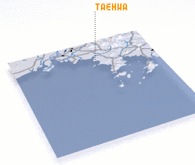 Places with similar names to T'aehwa, Korea, North ::
Disclaimer :: Information on this page comes without warranty of any kind |
||
|
Where is T'aehwa? Elevation and coordinates ::
Latitude (lat): 39°48'0"N Longitude (lon): 124°35'0"E
Elevation (approx.): 19m (map arrows pan, magnifying glasses zoom) |
||
|
Visiting T'aehwa? Hotel/Accommodation ::
Book a hotel in T'aehwa Travel Guide ::
rental cars ::
car rental offers GPS waypoint ::
download a GPX waypoint (PoI) of T'aehwa for your GPS receiver
|
||