|
search place name
|
||
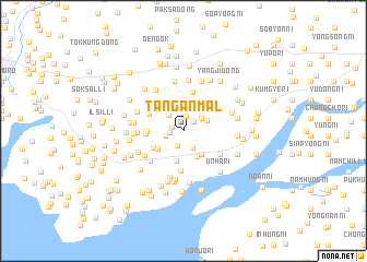
Tanganmal (P'yŏngan, Korea, North)Tanganmal is a town in the P'yŏngan region of Korea, North. An overview map of the region around Tanganmal is displayed below.
regional and 3d topo map of Tanganmal, Korea, North ::
Tanganmal airports ::
The nearest airport is FNJ - Pyongyang Intl, located 50.6 km south east of Tanganmal.
Nearby towns ::
Chinbok-tong (1.0km west) //
Wŏnsŏ-ri (1.2km north east) //
Yangji (1.1km west) //
Tŏkhyŏn-dong (1.6km north) //
Tongmogi (1.5km south) //
P'iam (1.5km west) //
Unhŭng-dong (1.9km south) //
Yongjang (2.0km north west) //
Naengch'ŏn-gol (1.9km north east) //
Naengjŏng-gol (2.1km north east) //
Ogya-dong (3.0km north) //
Unjŏl-li (2.9km south) //
Unjŏndong-Haso-ri (2.8km south east) //
Chagŭn-maŭl (3.2km north) //
Songŭm (2.7km south west) //
Sangso-ri (3.2km south) //
Sino-ri (3.2km north west) //
Muro-ri (2.9km south west) //
Yongmu (2.9km west) //
Yŏngbŏl-li (3.0km west) //
Kinjae (3.2km north west) //
Taehŭngdongsŏsori (4.1km south) //
Sumun-dong (4.1km north) //
Mipa-dong (3.6km north west) //
Unsan-dong (3.7km south east) //
Sŏlme (4.1km south west) //
Kwanmal (4.0km south west) //
Koju (3.7km west) //
Toganmal (4.9km south) //
[all distances 'as the bird flies' and approximate]  Places with similar names to Tanganmal, Korea, North ::
// Duncan Mill (US)
// Dunkannamulla (LK)
Disclaimer :: Information on this page comes without warranty of any kind |
||
|
Where is Tanganmal? Elevation and coordinates ::
Latitude (lat): 39°37'17"N Longitude (lon): 125°23'0"E
Elevation (approx.): 47m (map arrows pan, magnifying glasses zoom) |
||
|
Visiting Tanganmal? Hotel/Accommodation ::
Book a hotel in Tanganmal Travel Guide ::
rental cars ::
car rental offers GPS waypoint ::
download a GPX waypoint (PoI) of Tanganmal for your GPS receiver
|
||