|
search place name
|
||
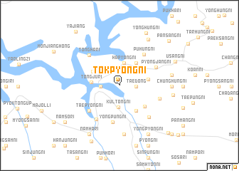
Tŏkp'yŏng-ni (P'yŏngan, Korea, North)Tŏkp'yŏng-ni is a town in the P'yŏngan region of Korea, North. An overview map of the region around Tŏkp'yŏng-ni is displayed below.
regional and 3d topo map of Tŏkp'yŏng-ni, Korea, North ::
Tŏkp'yŏng-ni airports ::
The nearest airport is FNJ - Pyongyang Intl, located 155.7 km south of Tŏkp'yŏng-ni.
Nearby towns ::
Tae-dong (2.0km east) //
Taedong-ni (2.2km west) //
Kultong-ni (3.4km south) //
Hap'yŏng-ni (3.5km north) //
Taep'yŏng-ni (4.0km north east) //
Ch'ang-ni (4.0km north east) //
Sangp'yŏng-ni (4.0km north east) //
Tongju-ri (3.4km west) //
Ch'ŏngge-ri (3.5km east) //
Pokch'ŏng-ni (4.4km south east) //
Yongam-ni (3.9km north west) //
Chunghŭng-ni (4.4km south east) //
Yŏngp'ung-ni (5.8km south) //
Puhŭng-ni (5.6km north east) //
Tap-tong (5.3km south west) //
T'aep'yŏng-ni (5.3km south west) //
P'yŏngjang-ni (5.2km north east) //
Ŏŭn-ni (6.0km south west) //
Naengsang-ni (5.2km south east) //
Tongha-ri (5.9km north west) //
Samhŭng-ni (6.1km south east) //
Yongsang-ni (7.7km south) //
Chunghŭng-ni (6.2km east) //
Sangp'yŏng-ni (6.4km east) //
Puhŭng-ni (8.0km north east) //
Ŭip'yŏng-ni (6.6km east) //
Yongp'yŏng-ni (8.4km south east) //
Namha-ri (8.5km south west) //
Kanhŭng-ni (8.5km south west) //
[all distances 'as the bird flies' and approximate] 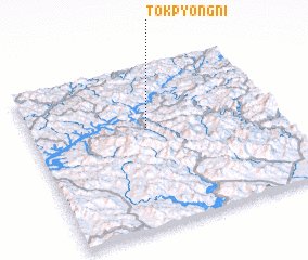 Places with similar names to Tŏkp'yŏng-ni, Korea, North ::
// Tŏkp'yŏng-ni (KR)
// Tŏkpyŏng-ni (KR)
Disclaimer :: Information on this page comes without warranty of any kind |
||
|
Where is Tŏkp'yŏng-ni? Elevation and coordinates ::
Latitude (lat): 40°37'7"N Longitude (lon): 125°28'35"E
Elevation (approx.): 197m (map arrows pan, magnifying glasses zoom) |
||
|
Visiting Tŏkp'yŏng-ni? Hotel/Accommodation ::
Book a hotel in Tŏkp'yŏng-ni Travel Guide ::
rental cars ::
car rental offers GPS waypoint ::
download a GPX waypoint (PoI) of Tŏkp'yŏng-ni for your GPS receiver
|
||