|
search place name
|
||
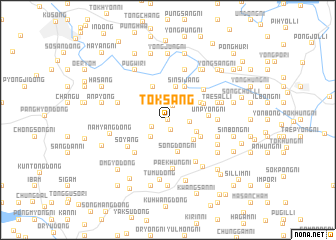
Tŏksang (Korea, North)Tŏksang is a town in Korea, North. An overview map of the region around Tŏksang is displayed below.
regional and 3d topo map of Tŏksang, Korea, North ::
Tŏksang airports ::
The nearest airport is FNJ - Pyongyang Intl, located 77.7 km south of Tŏksang.
Nearby towns ::
Tŏkchung (0.0km north) //
Oesang (1.1km south) //
Tŏkha (1.6km north) //
Sinhŭng (1.9km north) //
Naesang (1.6km south west) //
Tŏkhŭng-dong (1.9km east) //
Naeyang-dong (2.3km south west) //
Yongbong-ni (2.8km south east) //
Imch'ŏl-li (3.1km south east) //
Songdŏng-ni (3.7km south) //
Sagi-dong (3.7km north) //
Pongdŏk-tong (3.9km north) //
In-dong (3.4km south east) //
Kwansang-ni (3.4km north east) //
Sinsijang (4.0km north) //
Naeha-ri (3.5km north east) //
Unp'yŏng-ni (3.6km east) //
Namhŭng-ni (4.7km south west) //
Pongsang-ni (4.6km north east) //
Sŏyang (4.6km south west) //
Paekhŭng-ni (5.5km south) //
Pusŏng-ni (4.3km east) //
Songwŏl-li (5.3km south east) //
Ch'ŏnggye-dong (4.7km south east) //
Kiryong-ni (5.7km north) //
Tŏkp'ung (4.7km north west) //
Paeyang (4.7km north west) //
Taesal-li (4.7km north east) //
Sinhŭng-ni (5.1km south east) //
[all distances 'as the bird flies' and approximate]  Places with similar names to Tŏksang, Korea, North ::
Disclaimer :: Information on this page comes without warranty of any kind |
||
|
Where is Tŏksang? Elevation and coordinates ::
Latitude (lat): 39°53'0"N Longitude (lon): 125°22'0"E
Elevation (approx.): 74m (map arrows pan, magnifying glasses zoom) |
||
|
Visiting Tŏksang? Hotel/Accommodation ::
Book a hotel in Tŏksang Travel Guide ::
rental cars ::
car rental offers GPS waypoint ::
download a GPX waypoint (PoI) of Tŏksang for your GPS receiver
|
||