|
search place name
|
||
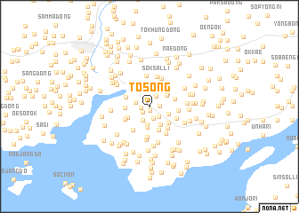
T'osŏng (P'yŏngan, Korea, North)T'osŏng is a town in the P'yŏngan region of Korea, North. An overview map of the region around T'osŏng is displayed below.
regional and 3d topo map of T'osŏng, Korea, North ::
T'osŏng airports ::
The nearest airport is FNJ - Pyongyang Intl, located 54.5 km south east of T'osŏng.
Nearby towns ::
Yong-dong (0.5km south) //
Sa-dong (0.8km west) //
Nae-dong (1.0km south west) //
Sangso-ri (1.0km east) //
Hwap'o (1.4km north east) //
Osal-li (1.5km south) //
Namsan (1.5km south east) //
Sam-ni (1.4km west) //
Sŏso-ri (1.9km south) //
Tongso-ri (2.3km south) //
Koŭm (2.1km south east) //
Ilsil-li (2.2km north east) //
I-ri (2.5km north) //
Kwanch'ang (2.6km south) //
Sudal (2.5km south east) //
Sangso-ri (2.4km north east) //
Sinch'ang-gol (2.3km west) //
Sa-ri (2.5km south west) //
Taesal-li (2.5km north west) //
Kusan (3.1km south) //
Kwangdong-ni (2.8km south east) //
Chungso-ri (2.6km east) //
Sinbong-ni (2.9km south west) //
Ch'angsan (3.2km south east) //
Kusŏng (2.8km east) //
Sangso-ri (3.4km south west) //
Saburan (3.0km south east) //
Sŏksanso-ri (3.8km north) //
Ch'ŏngnyongch'on (3.9km south) //
[all distances 'as the bird flies' and approximate] 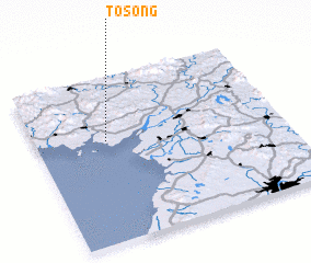 Places with similar names to T'osŏng, Korea, North ::
Disclaimer :: Information on this page comes without warranty of any kind |
||
|
Where is T'osŏng? Elevation and coordinates ::
Latitude (lat): 39°36'57"N Longitude (lon): 125°17'20"E
Elevation (approx.): 22m (map arrows pan, magnifying glasses zoom) |
||
|
Visiting T'osŏng? Hotel/Accommodation ::
Book a hotel in T'osŏng Travel Guide ::
rental cars ::
car rental offers GPS waypoint ::
download a GPX waypoint (PoI) of T'osŏng for your GPS receiver
|
||