|
search place name
|
||
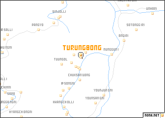
Turŭngbong (Hamgyŏng, Korea, North)Turŭngbong is a town in the Hamgyŏng region of Korea, North. An overview map of the region around Turŭngbong is displayed below.
regional and 3d topo map of Turŭngbong, Korea, North ::
Turŭngbong airports ::
The nearest airport is FNJ - Pyongyang Intl, located 248.6 km south west of Turŭngbong.
Nearby towns ::
Norumong-ni (0.5km north west) //
Kŏrim (1.5km north) //
Kaehwa-ri (2.1km south) //
Yonggaegok (1.8km north west) //
Yangbu-ri (2.1km south west) //
Nandŏng-ni (2.3km south) //
Sŏnsondŏng-ni (2.1km south west) //
Chuksan-dong (4.8km south) //
Tuŭn-gol (3.7km west) //
Nŭnggu-ri (5.2km east) //
Ipsŏng-ni (7.1km south) //
Pansŏng-ni (7.8km south west) //
Yŏun-ni (8.9km south east) //
Yŏunjung-ni (8.9km south east) //
Kogae (9.1km south west) //
Sanyang-ni (9.5km north west) //
[all distances 'as the bird flies' and approximate]  Places with similar names to Turŭngbong, Korea, North ::
Disclaimer :: Information on this page comes without warranty of any kind |
||
|
Where is Turŭngbong? Elevation and coordinates ::
Latitude (lat): 40°58'24"N Longitude (lon): 127°29'24"E
Elevation (approx.): 955m (map arrows pan, magnifying glasses zoom) |
||
|
Visiting Turŭngbong? Hotel/Accommodation ::
Book a hotel in Turŭngbong Travel Guide ::
rental cars ::
car rental offers GPS waypoint ::
download a GPX waypoint (PoI) of Turŭngbong for your GPS receiver
|
||