|
search place name
|
||
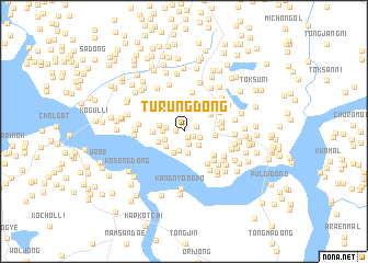
Turŭng-dong (Kaesŏng, Korea, North)Turŭng-dong is a town in the Kaesŏng region of Korea, North. An overview map of the region around Turŭng-dong is displayed below.
regional and 3d topo map of Turŭng-dong, Korea, North ::
Turŭng-dong airports ::
The nearest airport is GMP - Seoul Gimpo, located 35.8 km south east of Turŭng-dong.
Other airports nearby include SSN - Seoul East Seoul Ab (64.6 km south east), OSN - Osan Ab (91.3 km south east), FNJ - Pyongyang Intl (173.9 km north west), YEC - Yechon Yecheon (207.2 km south east), Nearby towns ::
Mindorim (0.6km north) //
Tokchŏng (0.7km south east) //
Nae-gol (0.7km west) //
Sinhŭng-ni (0.9km south east) //
Sagong-ni (1.1km north east) //
Sajŏng-mal (1.4km south) //
Mangp'o-ri (1.4km south east) //
O-dong (1.5km west) //
Kwan'gong-ri (1.8km south east) //
Chomul-li (2.0km south) //
Wŏllyŏ-dong (1.7km south west) //
Tongsan-mal (2.2km south) //
Hurŭng-ni (1.7km west) //
Karim-ni (2.2km north) //
Tae-gol (2.0km south west) //
Choryang-ch'on (2.3km south) //
Hŭngch'ŏl-li (2.0km west) //
Yŏngjŏng-ni (2.3km south west) //
Saenŭng-gol (2.5km west) //
Mokkwa-dong (2.8km north east) //
Chihyŏl-li (2.6km east) //
Wŏlchŏng-ni (2.9km east) //
Wŏram-ni (3.1km east) //
Sangjogang-ni (3.4km south east) //
Kajŏng-ni (3.2km east) //
Ponggok (4.0km north) //
Haeamjang (3.5km north east) //
Hajogang-ni (3.9km south east) //
Changgyŏng-ni (3.7km north west) //
[all distances 'as the bird flies' and approximate] 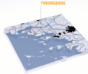 Places with similar names to Turŭng-dong, Korea, North ::
// Duriangadang (ID)
// Torang-dong (KP)
// T'orang-dong (KR)
// Tarangotong (PH)
// Trung Ðinh (2) (VN)
// Trung Ðồng (VN)
// Trung Ðồng (VN)
// Trung Dông (VN)
// Trung Dông (VN)
// Trung Tường (VN)
Disclaimer :: Information on this page comes without warranty of any kind |
||
|
Where is Turŭng-dong? Elevation and coordinates ::
Latitude (lat): 37°49'11"N Longitude (lon): 126°33'10"E
Elevation (approx.): 47m (map arrows pan, magnifying glasses zoom) |
||
|
Visiting Turŭng-dong? Hotel/Accommodation ::
Book a hotel in Turŭng-dong Travel Guide ::
rental cars ::
car rental offers GPS waypoint ::
download a GPX waypoint (PoI) of Turŭng-dong for your GPS receiver
|
||