|
search place name
|
||
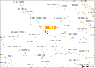
Twinolt'ŏ (Hamgyŏng, Korea, North)Twinolt'ŏ is a town in the Hamgyŏng region of Korea, North. An overview map of the region around Twinolt'ŏ is displayed below.
regional and 3d topo map of Twinolt'ŏ, Korea, North ::
Nearby towns ::
Sanghap'egi (2.5km south east) //
Chung-ch'on (2.6km north east) //
Pokchang-dong (4.1km south) //
Yongnam-dong (4.4km south east) //
Maehyang-ni (3.7km east) //
Hachingmŏri (3.9km west) //
Chik-tong (6.2km south) //
Chaengmyŏng-gol (5.9km north west) //
Norumogi (6.3km south) //
Sŏkki (5.0km east) //
Osa-gol (6.4km south) //
Ch'asu-ri (5.2km east) //
Sangjiktu (6.0km south west) //
Irŏnsang-ch'on (6.4km north east) //
Isudŏk (7.2km south) //
K'un tongsu-gol (6.3km north west) //
Ch'angsin-dong (6.7km south east) //
Poam (7.5km south) //
Hu-dong (7.3km south east) //
Pohwabo (7.8km south) //
Ŭng-gol (6.4km east) //
Ch'angsin-dong (8.0km south east) //
Ŭnsan-dong (8.8km south east) //
Irŏnha-ch'on (8.4km north east) //
Sinip-kol (9.3km north west) //
Tolgae (9.3km south east) //
Hyogyŏngsang-ch'on (9.2km north east) //
Kop'o-gol (9.5km south east) //
Paeksa-kol (9.9km south west) //
[all distances 'as the bird flies' and approximate]  Places with similar names to Twinolt'ŏ, Korea, North ::
// Twinlat (MM)
Disclaimer :: Information on this page comes without warranty of any kind |
||
|
Where is Twinolt'ŏ? Elevation and coordinates ::
Latitude (lat): 41°33'11"N Longitude (lon): 129°23'10"E
Elevation (approx.): 297m (map arrows pan, magnifying glasses zoom) |
||
|
Visiting Twinolt'ŏ? Hotel/Accommodation ::
Book a hotel in Twinolt'ŏ Travel Guide ::
rental cars ::
car rental offers GPS waypoint ::
download a GPX waypoint (PoI) of Twinolt'ŏ for your GPS receiver
|
||