|
search place name
|
||
Udan (Hamgyŏng, Korea, North)Udan is a town in the Hamgyŏng region of Korea, North. An overview map of the region around Udan is displayed below.
regional and 3d topo map of Udan, Korea, North ::

Nearby towns ::
Hap'yŏng-ni (0.8km south) //
Amjŏ (1.0km north) //
So-dong (1.1km north east) //
Chae-ch'on (1.4km north) //
Changhang (1.1km west) //
Sae-dong (1.3km west) //
Okho (1.4km south east) //
Sŏnch'ang (1.5km east) //
Okho (1.6km east) //
Chŏngmul-li (1.7km west) //
Yŏngjŏ (1.9km east) //
Puhŭng-dong (2.0km north east) //
Hansa-dong (2.4km north west) //
Ch'angdŏk (2.7km north) //
Ibae-dong (2.7km north) //
Su-dong (2.2km west) //
Kuryongp'o (2.4km west) //
Yŏnam (2.8km north east) //
Hangmyŏng-dong (4.1km north) //
Yongsan (3.2km west) //
Sin'gi (4.4km north) //
Tae-dong (3.7km north east) //
Am-ch'on (3.7km north west) //
T'owŏl-li (3.5km west) //
Hwangam-dong (4.1km south west) //
Ambang-dong (4.7km north west) //
Kaho (4.0km east) //
Hu-ri (4.6km south west) //
Chung-ch'on (5.2km north) //
[all distances 'as the bird flies' and approximate] 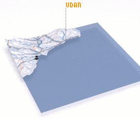 Places with similar names to Udan, Korea, North ::
Disclaimer :: Information on this page comes without warranty of any kind |
||
|
Where is Udan? Elevation and coordinates ::
Latitude (lat): 40°50'57"N Longitude (lon): 129°34'54"E
Elevation (approx.): 14m (map arrows pan, magnifying glasses zoom) |
||
|
Visiting Udan? Hotel/Accommodation ::
Book a hotel in Udan Travel Guide ::
rental cars ::
car rental offers GPS waypoint ::
download a GPX waypoint (PoI) of Udan for your GPS receiver
|
||