|
search place name
|
||
Ut-ch'on (Hamgyŏng, Korea, North)Ut-ch'on is a town in the Hamgyŏng region of Korea, North. An overview map of the region around Ut-ch'on is displayed below.
regional and 3d topo map of Ut-ch'on, Korea, North ::

Nearby towns ::
Sut'ang-gol (0.6km east) //
Hŏhang (0.9km east) //
Okp'o (1.2km north) //
Koam-ni (1.2km south) //
Kangmigi (1.5km north) //
Hyogyŏng-gol (1.3km south east) //
To-dong (1.5km south west) //
Ch'ŏngsal-li (1.7km north) //
Komsŏng-ni (1.8km south east) //
Yŏngmol (1.8km north east) //
P'yŏng-ch'on (2.0km north west) //
Tonggumi (1.9km south east) //
Ssangam-ni (2.1km south west) //
Yŏngdae (2.1km north east) //
Haksadae-ri (2.3km south east) //
Chung-ch'on (2.4km north west) //
Ŏgu-ch'on (3.1km north) //
Yŏnji (2.5km south west) //
Paenamukogae (2.7km west) //
P'ungam-ni (2.9km south west) //
Kwansŏ-ri (2.8km east) //
Tok-kol (3.7km north) //
Kokku-ri (3.1km north east) //
P'yŏng-ch'on (3.0km east) //
Yŏngt'ŏ-gol (3.8km north east) //
Ch'ongnyongan-gol (3.4km south west) //
Ch'ŏngdongni-sangch'on (4.0km north west) //
Sa-gol (4.6km north) //
Sŭngji-ch'on (3.9km north west) //
[all distances 'as the bird flies' and approximate] 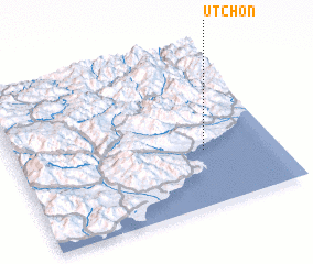 Places with similar names to Ut-ch'on, Korea, North ::
Disclaimer :: Information on this page comes without warranty of any kind |
||
|
Where is Ut-ch'on? Elevation and coordinates ::
Latitude (lat): 40°21'8"N Longitude (lon): 128°43'27"E
Elevation (approx.): 18m (map arrows pan, magnifying glasses zoom) |
||
|
Visiting Ut-ch'on? Hotel/Accommodation ::
Book a hotel in Ut-ch'on Travel Guide ::
rental cars ::
car rental offers GPS waypoint ::
download a GPX waypoint (PoI) of Ut-ch'on for your GPS receiver
|
||