|
search place name
|
||
Wŏnbong (Hamgyŏng, Korea, North)Wŏnbong is a town in the Hamgyŏng region of Korea, North. An overview map of the region around Wŏnbong is displayed below.
regional and 3d topo map of Wŏnbong, Korea, North ::

Nearby towns ::
Paenamugol (0.6km east) //
Immusugol (2.1km south) //
Sangdang-gol (2.2km south west) //
Ŭndŏk-tong (1.9km south west) //
Nabuk-tong (1.8km east) //
Nanam (2.1km east) //
Namsŏk-tong (2.7km south) //
Hap'yŏng (2.4km north west) //
Kudŏng-ni (2.3km south west) //
Togol (2.5km north east) //
Sajŏng-ni (2.6km west) //
Hoehyang-ni (3.1km north west) //
Pukchŏng-gol (3.0km south west) //
Tongmak-kol (3.6km north) //
Hujang-ni (3.2km north east) //
Chumakkŏri (4.5km south) //
Yonggang-dong (3.9km north east) //
Maam-dong (4.2km north east) //
Chungp'yŏng (3.6km west) //
Yongch'ŏn-dong (4.9km north) //
Sŏngnam-dong (4.8km south west) //
Tojigu (4.7km south east) //
Songbuk-tong (4.5km south east) //
Osang-ni (4.5km south west) //
Sŭngam-nodongjagu (5.5km south) //
Sangp'yŏng (4.2km west) //
Pongam-gol (4.7km south west) //
Kangbyŏnmaŭl (4.2km west) //
Ch'uga-gol (5.6km north) //
[all distances 'as the bird flies' and approximate] 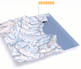 Places with similar names to Wŏnbong, Korea, North ::
Disclaimer :: Information on this page comes without warranty of any kind |
||
|
Where is Wŏnbong? Elevation and coordinates ::
Latitude (lat): 41°43'6"N Longitude (lon): 129°39'37"E
Elevation (approx.): 59m (map arrows pan, magnifying glasses zoom) |
||
|
Visiting Wŏnbong? Hotel/Accommodation ::
Book a hotel in Wŏnbong Travel Guide ::
rental cars ::
car rental offers GPS waypoint ::
download a GPX waypoint (PoI) of Wŏnbong for your GPS receiver
|
||