|
search place name
|
||
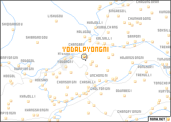
Yŏdalp'yŏng-ni (Yanggang, Korea, North)Yŏdalp'yŏng-ni is a town in the Yanggang region of Korea, North. An overview map of the region around Yŏdalp'yŏng-ni is displayed below.
regional and 3d topo map of Yŏdalp'yŏng-ni, Korea, North ::
Nearby towns ::
Taehŭng-ni (0.9km north) //
Sinhŭng-ni (1.2km south east) //
Yŏnghŭng-dong (1.1km east) //
Yŏndu-ri (1.6km north) //
Wiyŏn-dong (2.4km north) //
Yŏngch'ung-ni (2.1km south east) //
Sandang-ni (2.7km south) //
Changbai (2.9km north west) //
Hyesan-dong (2.5km west) //
Wiju-gol (3.5km south west) //
Yodong-ni (3.5km south west) //
Chung-ni (4.4km north) //
Hyesan (3.4km west) //
Songbong-dong (4.5km north east) //
Wangga-ri (5.1km north) //
Kŏmsal-li (4.4km north east) //
Chung-ni (3.9km east) //
Unch'ong-ni (4.8km south east) //
Chungbong-ni (4.2km south east) //
Malugou (5.3km north) //
K'alsal-li (4.9km north east) //
Chasal-li (5.7km south) //
Ongdong-ni (5.6km south) //
Chanp'o-ri (4.7km east) //
Ch'un-dong (5.0km south west) //
Majŏl-li (5.5km south east) //
An'gye-ri (6.5km south) //
Ch'ŏnsŏng-ni (6.5km south west) //
Kŏmsan-dong (5.8km north east) //
[all distances 'as the bird flies' and approximate] 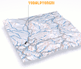 Places with similar names to Yŏdalp'yŏng-ni, Korea, North :: Disclaimer :: Information on this page comes without warranty of any kind |
||
|
Where is Yŏdalp'yŏng-ni? Elevation and coordinates ::
Latitude (lat): 41°23'36"N Longitude (lon): 128°12'42"E
Elevation (approx.): 849m (map arrows pan, magnifying glasses zoom) |
||
|
Visiting Yŏdalp'yŏng-ni? Hotel/Accommodation ::
Book a hotel in Yŏdalp'yŏng-ni Travel Guide ::
rental cars ::
car rental offers GPS waypoint ::
download a GPX waypoint (PoI) of Yŏdalp'yŏng-ni for your GPS receiver
|
||