|
search place name
|
||
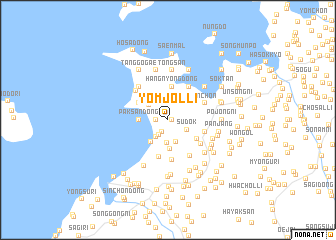
Yŏmjŏl-li (Hwanghae, Korea, North)Yŏmjŏl-li is a town in the Hwanghae region of Korea, North. An overview map of the region around Yŏmjŏl-li is displayed below.
regional and 3d topo map of Yŏmjŏl-li, Korea, North ::
Yŏmjŏl-li airports ::
The nearest airport is FNJ - Pyongyang Intl, located 96.2 km north east of Yŏmjŏl-li.
Other airports nearby include GMP - Seoul Gimpo (187.7 km south east), Nearby towns ::
Madŏk (0.4km east) //
Yabawi (1.1km west) //
Tŏkchŏng-ni (1.1km west) //
Saekke (1.1km west) //
Kura (1.4km south) //
T'aeŏl-li (1.8km south west) //
Si-dong (2.1km south west) //
Sudŏk (2.0km south east) //
Yangji-dong (2.5km south) //
Kunjang-dong (2.6km south) //
Naengjŏng-dong (2.4km north west) //
Yŏmch'on-dong (2.9km south west) //
Paksan-dong (2.5km west) //
Hayang-dong (3.2km south) //
Sangnae-dong (3.1km north west) //
Kim-ch'on (3.7km north) //
Hangnyŏng-dong (3.7km north) //
Sŏkke (3.7km north) //
Tŏgan-ni (3.7km north) //
An-dong (3.1km north west) //
Hanae-dong (3.1km north west) //
Sangyang-dong (3.3km south east) //
Ponghwang-dong (4.2km south) //
Panghwa-dong (3.5km east) //
Kangge-dong (4.1km north east) //
Saet'ŏ (4.1km north east) //
Kwŏndal-tong (4.5km south) //
Samhyŏn-dong (3.9km south east) //
Che-dong (3.8km north east) //
[all distances 'as the bird flies' and approximate] 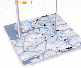 Places with similar names to Yŏmjŏl-li, Korea, North ::
Disclaimer :: Information on this page comes without warranty of any kind |
||
|
Where is Yŏmjŏl-li? Elevation and coordinates ::
Latitude (lat): 38°31'0"N Longitude (lon): 125°1'45"E
Elevation (approx.): 31m (map arrows pan, magnifying glasses zoom) |
||
|
Visiting Yŏmjŏl-li? Hotel/Accommodation ::
Book a hotel in Yŏmjŏl-li Travel Guide ::
rental cars ::
car rental offers GPS waypoint ::
download a GPX waypoint (PoI) of Yŏmjŏl-li for your GPS receiver
|
||