|
search place name
|
||
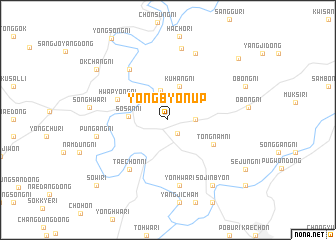
Yŏngbyŏn-ŭp (P'yŏngan, Korea, North)Yŏngbyŏn-ŭp is a town in the P'yŏngan region of Korea, North. An overview map of the region around Yŏngbyŏn-ŭp is displayed below.
regional and 3d topo map of Yŏngbyŏn-ŭp, Korea, North ::
Yŏngbyŏn-ŭp airports ::
The nearest airport is FNJ - Pyongyang Intl, located 66.8 km south of Yŏngbyŏn-ŭp.
Nearby towns ::
Namoesŏng-dong (1.7km south east) //
Tongoesŏng-dong (2.4km east) //
Yongp'o-ri (3.3km north) //
Kuhang-ni (3.9km north) //
Sŏsan-ni (3.4km west) //
Tongnam-ni (4.7km south east) //
Hwap'yŏng-ni (4.9km north west) //
Taech'ŏn-ni (6.4km south west) //
Kirhŭng-ni (6.5km north west) //
Yŏnhwa-ri (7.4km south) //
Namsan-ni (7.8km north) //
Sŏndol (8.1km north) //
Pun'gang-ni (6.4km west) //
Songhwa-ri (6.8km west) //
Sŏjinbyŏn (8.3km south east) //
Obong-ni (7.7km north east) //
Okch'ang-ni (8.3km north west) //
Sejung-ni (8.6km south east) //
Majŏn-dong (9.2km north east) //
Sŏwi-ri (9.6km south west) //
Saamch'am (9.9km south east) //
[all distances 'as the bird flies' and approximate] 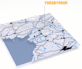 Places with similar names to Yŏngbyŏn-ŭp, Korea, North :: Disclaimer :: Information on this page comes without warranty of any kind |
||
|
Where is Yŏngbyŏn-ŭp? Elevation and coordinates ::
Latitude (lat): 39°48'58"N Longitude (lon): 125°48'19"E
Elevation (approx.): 146m (map arrows pan, magnifying glasses zoom) |
||
|
Visiting Yŏngbyŏn-ŭp? Hotel/Accommodation ::
Book a hotel in Yŏngbyŏn-ŭp Travel Guide ::
rental cars ::
car rental offers GPS waypoint ::
download a GPX waypoint (PoI) of Yŏngbyŏn-ŭp for your GPS receiver
|
||