|
search place name
|
||
Yŏngch'ang-ni (P'yŏngan, Korea, North)Yŏngch'ang-ni is a town in the P'yŏngan region of Korea, North. An overview map of the region around Yŏngch'ang-ni is displayed below.
regional and 3d topo map of Yŏngch'ang-ni, Korea, North ::

Yŏngch'ang-ni airports ::
The nearest airport is FNJ - Pyongyang Intl, located 111.0 km south west of Yŏngch'ang-ni.
Nearby towns ::
Sŭngt'ong-ni (0.2km east) //
Taep'yong-ni (1.7km north west) //
Sinp'yŏng (2.3km south) //
P'anmak (3.2km south) //
Yu-dong (3.2km east) //
Masan (4.8km south east) //
Sŏdangp'yŏng (5.3km south east) //
Samgŏri (4.6km north west) //
Tŏkhyŏn (5.7km south east) //
Saengch'ŏn (6.0km south east) //
Songsan-ni (6.1km south east) //
Tarik-kol (6.1km west) //
Myŏnghak-kol (7.1km south east) //
Songp'yŏng-ni (7.5km south) //
Chijangam (6.3km west) //
Soryonggae (6.4km east) //
Kwanp'yŏng (8.5km south) //
Taehŭng-dong (8.7km south) //
Hoe-gol (8.1km south west) //
Kwŏnnongam (8.4km south east) //
Kyesong-dong (9.3km south west) //
Ŭi-dong (10.3km south west) //
[all distances 'as the bird flies' and approximate] 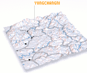 Places with similar names to Yŏngch'ang-ni, Korea, North ::
// Yongch'ang-ni (KP)
// Yŏngch'ung-ni (KP)
// Yŏngch'ang-ni (KR)
// Yongch'ang-ni (KP)
// Hyangch'ŏng-ni (KP)
// Yŏngch'ŏng-ni (KP)
// Yangshanguan (CN)
// Yangtiancun (CN)
Disclaimer :: Information on this page comes without warranty of any kind |
||
|
Where is Yŏngch'ang-ni? Elevation and coordinates ::
Latitude (lat): 39°58'12"N Longitude (lon): 126°31'48"E
Elevation (approx.): 334m (map arrows pan, magnifying glasses zoom) |
||
|
Visiting Yŏngch'ang-ni? Hotel/Accommodation ::
Book a hotel in Yŏngch'ang-ni Travel Guide ::
rental cars ::
car rental offers GPS waypoint ::
download a GPX waypoint (PoI) of Yŏngch'ang-ni for your GPS receiver
|
||