|
search place name
|
||
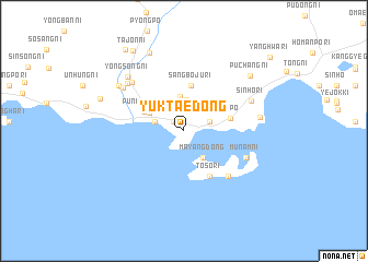
Yuktae-dong (Hamgyŏng, Korea, North)Yuktae-dong is a town in the Hamgyŏng region of Korea, North. An overview map of the region around Yuktae-dong is displayed below.
regional and 3d topo map of Yuktae-dong, Korea, North ::
Yuktae-dong airports ::
The nearest airport is SHO - Sokch'o Sokcho, located 212.4 km south of Yuktae-dong.
Nearby towns ::
Yŏngmu-dong (1.3km north west) //
Yŏnho-dong (2.2km north east) //
Songnae (2.4km north west) //
Chungboju-ri (3.2km north) //
Mayang-dong (3.1km south east) //
Poju-ri (3.5km north) //
Yŏngdae-ri (3.3km north west) //
P'ungŏ-dong (3.6km north west) //
Sangboju-ri (4.7km north) //
Sinp'o (3.9km east) //
Tosŏ-ri (5.0km south east) //
Chunghŭng-ni (5.7km south east) //
Sambat'kae (5.7km south east) //
Munam-ni (5.6km south east) //
Chungdŏng-ni (6.4km north west) //
Sinho-ri (6.1km north east) //
Yongjung-ni (6.6km north west) //
Sinp'ung-ni (6.5km north west) //
Namgoji (6.1km east) //
Yongsŏng-ni (7.1km north west) //
Chungyang-ni (6.9km north west) //
Ch'ŏnha-ri (8.4km north) //
Puch'ang-ni (7.7km north east) //
Unp'o-rodongjagu (7.3km north west) //
Tajŏn-ni (9.1km north west) //
Samsŏng-ni (9.5km north west) //
Yanghwa-ri (10.0km north east) //
[all distances 'as the bird flies' and approximate] 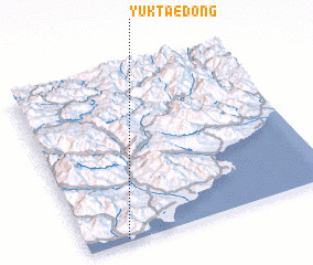 Places with similar names to Yuktae-dong, Korea, North ::
// Yuktae-dong (KP)
Disclaimer :: Information on this page comes without warranty of any kind |
||
|
Where is Yuktae-dong? Elevation and coordinates ::
Latitude (lat): 40°1'29"N Longitude (lon): 128°9'35"E
Elevation (approx.): 4m (map arrows pan, magnifying glasses zoom) |
||
|
Visiting Yuktae-dong? Hotel/Accommodation ::
Book a hotel in Yuktae-dong Travel Guide ::
rental cars ::
car rental offers GPS waypoint ::
download a GPX waypoint (PoI) of Yuktae-dong for your GPS receiver
|
||