|
search place name
|
||
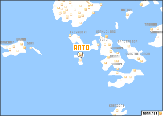
Ant'ŏ (Chŏlla, Korea, South)Ant'ŏ is a town in the Chŏlla region of Korea, South. An overview map of the region around Ant'ŏ is displayed below.
regional and 3d topo map of Ant'ŏ, Korea, South ::
Ant'ŏ airports ::
The nearest airport is KWJ - Kwangju Gwangju, located 96.7 km north east of Ant'ŏ.
Other airports nearby include CJU - Cheju Jeju Intl (128.8 km south), RSU - Yeosu (152.9 km east), KUB - Kunsan Ab (157.0 km north), Nearby towns ::
Ant'ae (0.5km south west) //
Sindo (0.9km north) //
T'onggumi (2.9km north east) //
Taeyado-ri (4.9km north) //
Nŭngsal-li (4.4km north east) //
P'ich'on (4.7km east) //
Hongaeburi (5.6km north) //
Ŏŭl-li (5.1km east) //
Tae-ri (5.4km north east) //
Sop'o-ri (6.2km north east) //
Kyedo (6.2km north east) //
Unggok (5.7km east) //
Chŏn'gwang-ni (6.1km north east) //
Chŏnwŏl-li (6.1km north east) //
Wŏnhugwang (6.8km north east) //
Orim-ni (6.5km east) //
Ŏlgim (8.1km north) //
Orim (6.8km east) //
Pukp'o-ri (6.9km east) //
Nodo-ri (7.3km east) //
Yuho-ri (7.3km east) //
Hat'aesŏ-ri (7.6km south east) //
[all distances 'as the bird flies' and approximate] 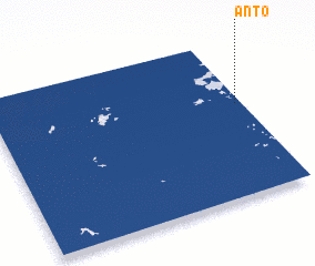 Places with similar names to Ant'ŏ, Korea, South ::
Disclaimer :: Information on this page comes without warranty of any kind |
||
|
Where is Ant'ŏ? Elevation and coordinates ::
Latitude (lat): 34°35'22"N Longitude (lon): 125°58'32"E
Elevation (approx.): 31m (map arrows pan, magnifying glasses zoom) |
||
|
Visiting Ant'ŏ? Hotel/Accommodation ::
Book a hotel in Ant'ŏ Travel Guide ::
rental cars ::
car rental offers GPS waypoint ::
download a GPX waypoint (PoI) of Ant'ŏ for your GPS receiver
|
||