|
search place name
|
||
Chiryŏng-gol (Kangwŏn, Korea, South)Chiryŏng-gol is a town in the Kangwŏn region of Korea, South. An overview map of the region around Chiryŏng-gol is displayed below.
regional and 3d topo map of Chiryŏng-gol, Korea, South ::

Chiryŏng-gol airports ::
The nearest airport is SHO - Sokch'o Sokcho, located 40.4 km north east of Chiryŏng-gol.
Other airports nearby include KAG - Kangnung Gangneung (69.6 km east), SSN - Seoul East Seoul Ab (111.5 km south west), GMP - Seoul Gimpo (131.9 km west), OSN - Osan Ab (141.5 km south west), Nearby towns ::
Hach'on (1.4km south west) //
Pakakkŏul (2.7km north east) //
Kimburak (5.3km south) //
Kimbu-ri (5.6km south) //
Wae-gol (4.8km south east) //
Nŭmbawi (4.8km south west) //
Sojae (5.1km west) //
Paekcha-dong (6.9km south) //
Sŏnanggŏri (7.2km south west) //
Tosuam (6.7km west) //
Kolmal (7.6km north west) //
Pongnamdae (8.4km south) //
Kŭmba-ri (8.3km north) //
Kŏmusŏk (7.7km north east) //
Namjŏn (8.2km north west) //
Wŏn'gaptul-li (7.7km south west) //
Karo-ri (8.9km north west) //
Twijae (8.0km north west) //
Hup'yŏng-dong (10.3km south east) //
[all distances 'as the bird flies' and approximate] 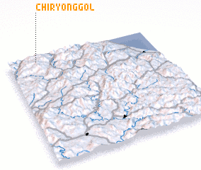 Places with similar names to Chiryŏng-gol, Korea, South ::
// Ch'auryŏnggol (KP)
// Choryong-gol (KR)
Disclaimer :: Information on this page comes without warranty of any kind |
||
|
Where is Chiryŏng-gol? Elevation and coordinates ::
Latitude (lat): 37°57'46"N Longitude (lon): 128°11'52"E
Elevation (approx.): 673m (map arrows pan, magnifying glasses zoom) |
||
|
Visiting Chiryŏng-gol? Hotel/Accommodation ::
Book a hotel in Chiryŏng-gol Travel Guide ::
rental cars ::
car rental offers GPS waypoint ::
download a GPX waypoint (PoI) of Chiryŏng-gol for your GPS receiver
|
||