|
search place name
|
||
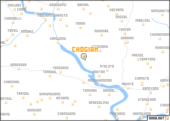
Chogiam (Ch'ungch'ŏng, Korea, South)Chogiam is a town in the Ch'ungch'ŏng region of Korea, South. An overview map of the region around Chogiam is displayed below.
regional and 3d topo map of Chogiam, Korea, South ::
Chogiam airports ::
The nearest airport is OSN - Osan Ab, located 68.9 km west of Chogiam.
Other airports nearby include SSN - Seoul East Seoul Ab (70.4 km north west), YEC - Yechon Yecheon (74.0 km south east), GMP - Seoul Gimpo (101.5 km north west), KAG - Kangnung Gangneung (122.3 km north east), Nearby towns ::
Kkŭt'chŏngja (2.5km north east) //
Tangmoru (3.4km north east) //
Pokt'an (4.2km south east) //
Nŭng-gol (4.9km south) //
Pyŏlmyo (4.4km south east) //
Yongdang (5.0km south west) //
Ponghwangnae (5.9km south east) //
Nŭngnae (6.4km north east) //
Kangjŏng (6.2km north west) //
Taman (7.3km north) //
Tongmak (7.6km south) //
Tangdŭl (7.1km south west) //
Sŏwŏnmal (8.4km north west) //
Wŏn-gol (8.6km south east) //
Nŏdŏri (8.1km north east) //
Yuhyŏn (9.2km north east) //
Ke-ri (9.9km north west) //
Sinhŭng-dong (10.3km south west) //
Ong-gol (10.9km north east) //
[all distances 'as the bird flies' and approximate] 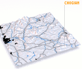 Places with similar names to Chogiam, Korea, South ::
Disclaimer :: Information on this page comes without warranty of any kind |
||
|
Where is Chogiam? Elevation and coordinates ::
Latitude (lat): 37°7'50"N Longitude (lon): 127°48'12"E
Elevation (approx.): 73m (map arrows pan, magnifying glasses zoom) |
||
|
Visiting Chogiam? Hotel/Accommodation ::
Book a hotel in Chogiam Travel Guide ::
rental cars ::
car rental offers GPS waypoint ::
download a GPX waypoint (PoI) of Chogiam for your GPS receiver
|
||