|
search place name
|
||
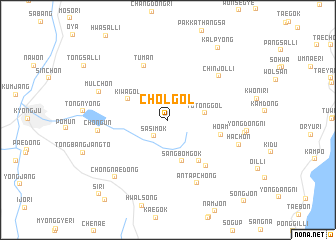
Chŏl-gol (Kyŏngsang, Korea, South)Chŏl-gol is a town in the Kyŏngsang region of Korea, South. An overview map of the region around Chŏl-gol is displayed below.
regional and 3d topo map of Chŏl-gol, Korea, South ::
Chŏl-gol airports ::
The nearest airport is KPO - Pohang, located 17.4 km north of Chŏl-gol.
Other airports nearby include USN - Ulsan (27.5 km south), TAE - Taegu Daegu Ab (62.9 km west), PUS - Kimhae Gimhae Intl (82.5 km south west), YEC - Yechon Yecheon (125.4 km north west), Nearby towns ::
Sasimok (2.2km south west) //
Tot'ong-gol (3.4km east) //
Sangbŏmgok (4.8km south) //
Kiwa-gol (4.3km north west) //
Chaegung-dong (5.4km south east) //
Hoam (5.1km east) //
Tuman (6.4km north) //
Changhang-ni (6.2km south east) //
Chinjŏl-li (6.8km north east) //
Ant'apchŏng (7.5km south) //
Ch'ŏn'gun (6.4km west) //
Mulch'ŏn (7.0km north west) //
Hach'ŏn (7.0km south east) //
Huch'on (7.1km east) //
Chŏngnae-dong (8.0km south west) //
Yongdong-ni (7.3km east) //
Kalp'yŏng (9.3km north east) //
Si-ri (10.4km south west) //
[all distances 'as the bird flies' and approximate] 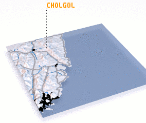 Places with similar names to Chŏl-gol, Korea, South ::
// Chelkelī (IR)
// Cholāqlū (IR)
// Chalkley (US)
// Siālkol (BD)
// Chalcalo (EC)
// Chillogallo (EC)
// Chilagual (SV)
// Chilaquila (MX)
// Chulakly (UZ)
// Chilikila (ZM)
Disclaimer :: Information on this page comes without warranty of any kind |
||
|
Where is Chŏl-gol? Elevation and coordinates ::
Latitude (lat): 35°50'29"N Longitude (lon): 129°21'9"E
Elevation (approx.): 268m (map arrows pan, magnifying glasses zoom) |
||
|
Visiting Chŏl-gol? Hotel/Accommodation ::
Book a hotel in Chŏl-gol Travel Guide ::
rental cars ::
car rental offers GPS waypoint ::
download a GPX waypoint (PoI) of Chŏl-gol for your GPS receiver
|
||