|
search place name
|
||
Chŏpchi-ri (Chŏlla, Korea, South)Chŏpchi-ri is a town in the Chŏlla region of Korea, South. An overview map of the region around Chŏpchi-ri is displayed below.
regional and 3d topo map of Chŏpchi-ri, Korea, South ::

Chŏpchi-ri airports ::
The nearest airport is KWJ - Kwangju Gwangju, located 44.1 km south of Chŏpchi-ri.
Other airports nearby include KUB - Kunsan Ab (45.9 km north west), RSU - Yeosu (105.0 km south east), TAE - Taegu Daegu Ab (171.7 km east), OSN - Osan Ab (174.9 km north), Nearby towns ::
Chunghŭng-ni (0.8km south) //
P'yŏngam (3.1km south west) //
Wŏnch'ŏnwŏn (3.1km south west) //
Ch'ŏnwŏl-li (3.0km south west) //
Kwagyo-dong (3.3km north east) //
Yŏnwŏl-li (4.9km south west) //
Tŭnggye-ri (4.9km north west) //
Sinsŏng-ni (4.6km east) //
Taewŏl (4.6km west) //
Sallim-ni (4.6km west) //
Chŏngŭp (5.8km north east) //
Pohwa-ri (5.8km north west) //
Hap'yŏng-dong (6.8km north) //
Mansu-ri (6.8km north) //
Mongnan (8.4km south) //
Ipsŏng-ni (8.9km north) //
Taega (8.8km south east) //
Paegam-ni (9.4km south west) //
Chongam (9.0km north west) //
Taedari (10.4km north west) //
[all distances 'as the bird flies' and approximate] 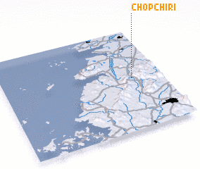 Places with similar names to Chŏpchi-ri, Korea, South ::
// Chapshar (RU)
Disclaimer :: Information on this page comes without warranty of any kind |
||
|
Where is Chŏpchi-ri? Elevation and coordinates ::
Latitude (lat): 35°31'26"N Longitude (lon): 126°49'1"E
Elevation (approx.): 47m (map arrows pan, magnifying glasses zoom) |
||
|
Visiting Chŏpchi-ri? Hotel/Accommodation ::
Book a hotel in Chŏpchi-ri Travel Guide ::
rental cars ::
car rental offers GPS waypoint ::
download a GPX waypoint (PoI) of Chŏpchi-ri for your GPS receiver
|
||